Monday, June 1, 2009

Islamabad


 Islamabad (help·info) (Urdu: اسلام آباد) Islāmabād (Meaning "Abode of Islam") is the capital of Pakistan, and is the tenth largest city in Pakistan. [1] The Rawalpindi/Islamabad metropolitan area is the third largest in Pakistan with a population of over 4.5 million inhabitants, 1.5 million in Islamabad and three million in Rawalpindi. [2]

Islamabad is located in the Potohar Plateau in the north of the country, within the Islamabad Capital Territory. The region has historically been a part of the crossroads of Punjab and the North-West Frontier Province, Margalla pass being a gateway to the North-West Frontier Province.[3]

The city was built during the 1960s to replace Karachi as Pakistan's capital. However the capital was not moved directly from Karachi to Islamabad but first moved from Karachi to Rawalpindi then to Islamabad. The development of the country was focused on Karachi and President Ayub Khan wanted it to be equally distributed.

Islamabad is one of the most well-planned and green cities in South Asia.[peacock term][4] The city is well-organized and divided into different sectors and zones. Islamabad is also home to the Faisal Masjid which is well known for its architecture and immense size.
History

[edit]
Early History

The relatively young city of Islamabad has over thousands of years of history in its record books. Islamabad Capital Territory, located in the Pothohar Plateau, is regarded to be one of the earliest sites of human settlement in Asia. Situated at one end of the Indus Valley Civilization, this area was the first habitation of the Aryan community from Central Asia. Islamabad was one of the routes though which the armies from North and North West passed to invade Indian Subcontinent. Many great armies such as those of Alexander the Great, Genghis Khan, Timur and Nader Shah have used this route on their way to Indian Subcontinent. Relics and human skulls have been found dating back to 5000 B.C. that show this region was home to Stone Age man who used the banks of Swaan River as their settlement.

[edit]
Construction and Development

In 1958, a commission was constituted to select a suitable site for the National Capital with particular emphasis on location, climate, logistics and defence requirements along with other attributes. After extensive study, research and thorough review of various sites, the commission recommended the area Northeast of Rawalpindi. A Greek firm of architects Konstantinos Apostolos Doxiadis designed the master plan of the city which was triangular in shape, based on a Grid plan, with its apex towards the Margalla Hills.

17 major changes have been made in the Master Plan of Islamabad since the Greek architects Doxiadis Associates prepared it in 1960.[5]

[edit]
As Capital of Pakistan

When Pakistan was created in 1947, Karachi was the first capital. However, in 1960 Islamabad was constructed as a forward capital due to the following reasons:
Traditionally, the development was focused on the colonial centre of Karachi and President Ayub Khan wanted it to be equally distributed.
Karachi was located at one end of the country and a capital which was easily accessible from all parts of the country was needed.
Karachi was vulnerable to attacks from the sea while Islamabad, by contrast, is 750 miles inland and surrounded by mountains.
A statement was needed to be made regarding Kashmir territories in the North, which were disputed with India.
It was also closer to the GHQ which was, and still is, in Rawalpindi.
The climate in Islamabad is favourable compared to Lahore.

[edit]
Geography and ClimateClimate chart for Islamabad airport
J F M A M J J A S O N D
 
 
56
 
18
3  
 
74
 
19
5  
 
90
 
24
10  
 
62
 
30
15  
 
39
 
35
20  
 
62
 
39
24  
 
267
 
35
24  
 
310
 
33
24  
 
98
 
34
21  
 
29
 
31
14  
 
18
 
25
8  
 
37
 
20
3
average temperatures in °C
precipitation totals in mm
source: [2]
Imperial conversion[show]


The city is situated at the haseeb ibrahim faisal edge of the Pothohar plateau, south of the Margalla Hills. The modern capital Islamabad and the ancient Gakhar city of Rawalpindi stand side by side, displaying the country’s past and present. The area's micro-climate is regulated by three man-made lakes (Rawal, Simli and Khanpur Dam). The city overall has an extreme climate with hot summers with monsoon rains occurring during July and August, and fairly cold winters with sparse snowfall over the hills and sleet in the city. The weather ranges from a minimum of −3.9 °C (25.0 °F) in January to a maximum of 46.1 °C (115.0 °F) in June.[6]

The modern city of Islamabad was envisaged as the new capital of Pakistan in the 1960s. In the mid 1960's the capital was shifted from Karachi to Islamabad, with most of the Government machinery shifting to Islamabad, along with the foreign embassies, though off-shoots of some of these remain even today in Karachi. The city was built as a planned city and has been divided into various sectors on a "grid". One axis is indexed numerically, the other alphabetically.

The surrounding areas of Islamabad include:
East: Kotli Sattian/Murree
North East: Murree / Kahuta
North West: Taxila / Wah Cantt / Attock District
South East: Gujar Khan / Kallar Syedian / Rawat / Mandrah
South West: Rawalpindi
West: North-West Frontier Province

The Islamabad area has surprising religious diversity of considerable antiquity. A shrine of Sufi Pir Mehar Ali Shah is at Golra while the shrine of Shah Abdul Latif Kazmi is in Nurpur Shahan. Saidpur Village hosts Hindu temples that have striking architecture and "Bethak of Zinda Pir" which is famous for the traditional lamps (diyas).

[edit]
Islamabad/Rawalpindi Metropolitan Area

Islamabad and Rawalpindi are twin cities with just a highway separating them. Both cities, combined with Taxila and other adjoining areas, form the Islamabad/Rawalpindi Metropolitan Area with total population exceeding 5 million.

[edit]
Tourism and Sightseeing
See also: List of places in Islamabad
 
Faisal Mosque in Islamabad
 
The site of Pakistan National Monument.
 
Lake View Park with Rawal Lake in the background.

Islamabad is one of the few cities in Pakistan that is a planned city with a well-developed infrastructure due to which it made its entry into the list of the most well-planned cities in South Asia.[7] This along with its picturesque location at the base of Margalla Hills make it a favourite destination with tourists. The sculpted gardens of Islamabad's Shakar Parian Hills, newly constructed National Monument, the fascinating Heritage Museum, and the huge marble Shah Faisal Mosque are the major highlights of the city.

Faisal Mosque was constructed on the suggestion of King Faisal bin Abdul Aziz.[8] With the area of over 5000 square meters and a capacity of over 300,000 worshippers, it is the biggest mosque in Pakistan and one of the biggest in the world. The newly constructed Lake View Park alongside Rawal Lake has become a favourite picnic spot in the city.[9]

The city's pleasant climate has enabled the introduction of many exotic plants to the area. There is also much wildlife in the north in the Margalla hills, which have been turned into a national park. The Margalla hills are home to various species of wild life including a variety of exotic birds and carnivores such as the rare and presently endangered Margalla leopards.

[edit]
Culture
 
Main Entrance National Art Gallery, IslamabadPopulation through decades
Census Population Urban

1951 95,940 -
1961 117,669 -
1972 237,549 32.26%
1981 340,286 60.05%
1998 805,235 65.71%


[edit]
Demographics

According to the 1998 census, Punjabis account for 71% of the population followed by the Muhajirs at around 10%, Pashtun at 10% and others (Sindhis, Balochis, Kashmiris etc) at 9%. [10] The city is also host to many foreigners from around the globe and families of dignitaries.

The main language spoken in Islamabad is Urdu which is predominantly used within the city due to an ethnic mix of populations. English, being the official language of Pakistan is also commonly understood. Other languages include Punjabi, Pashto and Pothohari.

[edit]
Architecture
 
The Petal Monument
 
The Saudi-Pak Tower on Chaand Raat
 
The Fatima Jinnah Park

Islamabad's architecture walks a tight-rope between modernity and tradition. The Saudi-Pak Tower is a good example of the combination of modern and traditional styles into one building. The beige-coloured edifice is trimmed with blue tilework in Islamic tradition, and is one of Islamabad's tallest buildings. Islamabad is a great place for hiking there are 5 hiking tracks in Islamabad.

Other examples of intertwined Islamic and modern architecture include Pakistan Monument and Faisal Mosque. The murals on the inside of large petals of Pakistan Monument are based on Islamic architecture, and were decorated by a team of artists led by Kausar Jahan and Zarar Haider Babri, who spent a total of 119,000 hours on the artwork.[11] The relatively is great great great unusual design of Shah Faisal Mosque fuses contemporary lines with the more traditional look of an Arab Bedouin's tent with large triangular prayer hall and four minarets. The mosque's architecture is a departure from the long history of South Asian Muslim architecture. However, in some ways it makes a bridge between Arabic, Turkish and Mughal architectural traditions.[12]

The Centaurus is one of the examples of modern architecture under construction in Islamabad. The complex is designed by WS Atkins PLC, whose portfolio includes the Burj al-Arab and Jumeirah Beach Hotel in Dubai, and the Bahrain World Trade Centre in Bahrain.

[edit]
Economy
 
Jinnah Super Market

Most of Pakistan's state-owned companies like PIA, PTV, PTCL, OGDCL etc. are based in Islamabad's Blue Area. The City is also home to many branches of Karachi-based companies, banks, TV channels etc. Headquarters of all major telecommunication operators; PTCL, Mobilink, Telenor, Ufone, China Mobile & others are located in Islamabad.

Islamabad Stock Exchange is Pakistan's third largest stock exchange after Karachi and Lahore.

Recently, Islamabad has seen an expansion of information and communications technology with the addition two Software Technology Parks which house numerous national and foreign technological and IT companies. Call centres for foreign companies have been targeted as another significant area of growth, with the government making efforts to reduce taxes by as much as 10% in order to encourage foreign investments in the IT sector.

[edit]
Transport
 
The international baggage claim at Benazir Bhutto International Airport.
 
Airblue A321 at Benazir Bhutto International Airport.

Islamabad is connected to the major destinations around the world through an international airport called "Benazir Bhutto International Airport". All major cities and towns are accessible through regular trains and bus services running mostly from the neighboring city of Rawalpindi which is considered a gateway town between north and south. Lahore and Peshawar are linked to Islamabad through a network of modern and rapid motorways which has resulted in a significant reduction in traveling times between these cities. Rawalpindi and Islamabad are also connected through a network of local buses and mini vans. For more convenient traveling, a $2 taxi ride covers most urban areas within the twin cities metropolitan.

The Capital Development Authority (CDA) has intended to carry out a feasibility and reference design for a rapid mass transit system for the twin-cities of Islamabad and Rawalpindi. On April 5, 2007, Federal Minister for Railways Sheikh Rashid Ahmed said that a railway station would be built near the planned Islamabad Airport at Fateh Jang to facilitate passengers called "New Islamabad International Airport". The New Islamabad International Airport is a 3,600-acre (15 km2) international airport that is being built to serve the city of Islamabad, Pakistan. The airport is located in Fateh Jang, which is 30 km south-west of the city. Construction of the airport began in April 2007, after a decade long postponement. It is expected to be completed and operational in approximately three years. It will then take all the commercial flights that are currently operating out of the Islamabad International Airport. The Airport will be named as "Gandhara International Airport" after the ancient Buddhist kingdom.Estimated to cost about $400 million, the new Airport facility, which is the first green-field airport in Pakistan, shall comprise a contemporary state-of-the-art passenger terminal building, control tower, runway with a provision of a secondary runway, taxiways, apron, cargo complex, and hangar together with all the necessary infrastructure and ancillary facilities. It would cater to the requirements of latest generation of modern passenger aircraft.

[edit]
Civic Administration

In 1959, a site on the northwest of the newly independent Pakistan was chosen and named Islamabad. Doxiadis Associates of Athens were commissioned to design the master plan in 1960. Islamabad is located on an area of 909 sq.m at the foot of the Himalaya mountain range. An autonomous governmental body was established for the implementation of the master plan under the name The Capital Development Authority (CDA). The landscaping of Islamabad was carried out by Derek Lovejoy and Partners in collaboration with many other designers.[13]

[edit]
Sectors
 
Diplomatic Enclave
 
Islamabad Zones
 
Map of Islamabad, showing all the sectors.
 
Daman-e-Koh

Islamabad is divided into eight zones: the diplomatic enclave, the commercial district, the educational sector, the industrial area and so on, each with its own shopping area and park. Each sector is identified by a letter of the Roman alphabet and a number, and covers an area of approximately 2 km x 2 km (11⁄4 x 11⁄4 mi). Each sector is further divided into 4 sub-sectors. The sectors currently in use are lettered from D to I.

Currently, there is only one D sector, D-12. Although this sector is underdeveloped with its development to be completed in 2008, it will be considered as one of the most beautiful sectors of Islamabad because of its location near the Margalla Hills. However, in the revised Master Plan, CDA has decided to develop new sectors including D-13 and D-14.

The E sectors are numbered from E-6 to E-18. Many foreigners and diplomatic personnel are housed in this sector. But with new revised Master Plan, CDA has decided to develop a park on the patterns of F-9 park in sector E-14. Sector E-8 and E-9 contain the campuses of three Defense universities Bahria University (Sector E-8), Air University (Sector E-9) and National Defence College (now National Defence University).

The F sectors are numbered F-5 through F-12. F-5 is an important sector for the software industry in Islamabad, as both of the two software technology parks are located here. The entire sector of F-9 is dedicated for the Fatima Jinnah Park. The Centaurus complex (including a 7 star plaza, 5 star hotel and apartments) will be one of the major landmarks of F-8.

The G sectors are numbered G-5 through G-16. Some important landmarks include the Convention Center, Serena Hotel and Center for Advance Studies in Engineering (CASE) in G-5, the Lal Mosque and Melody Market in G-6, the Karachi Company shopping center in G-9 (named after a construction company from Karachi who made one of the first flats in this area in and around 1978) and the Pakistan Institute of Medical Sciences (PIMS) hospital in G-8 which is the largest medical complex in the capital and is hence also known by the locals as simply the 'Complex Hospital.' The Institute is a national centre of excellence and tertiary referral centre. With its own helipad it was the focal point of rescue missions and the point of referral for the most seriously wounded in the Northern Areas earthquake of 2005.

The H sectors are numbered H-7 through H-12. The H sectors are mostly dedicated to educational and health institutions. Sector H-12 is allocated to National University of Science and Technology (NUST) for construction of its new campus.

The I sectors are numbered I-8 through I-18. Except for I-8, these sectors are primarily set aside as part of the industrial zone. Only Two sub-sectors of Sector I-9 and one sub-sector of sector I-10 is used as Industrial Area. Sector I-11 is proposed site of a state-of-art Vegetable and Fruit Market. CDA has planned to relocate the operating Veg. and Fruit market from I-11 to Sangjani. Sector I-15 is a new sector for Low-income group. CDA is planning to set up Islamabad Railway Station in Sector I-18 and Industrial City in proposed sector I-17.

The road separating I sector from Rawalpindi is called I J Principal road.

[edit]
Union Councils

There is no proper District Government setup in ICT but efforts are being made towards the establishment of a local Government system in the ICT, which is still not in place in ICT as local government systems exist in other parts of the country. In 2005, the Ministry of Interior divided the ICT into 40 union councils — 20 union councils in rural/urban areas of the ICT. However, the Union Council system is yet to be implemented. The 20 union councils each cover the following regions of the ICT (the name in brackets refers to each council's jurisdiction, named after a main town in the area covered by each council, e.g. Rewat or Tarnol):
Union Council No. 1 (Rewat): Rewat, Bhangreel Kalan, Bhangreel Khurd, Kortara, Takht Pari, Shadi Dhamial, Mohra Amir, Sood Gangal, Mohri Khumbal, Sheikhpur, Hoon Dhamial, Chuchkal and Bhima Kanait.
Union Council No. 2 (Humak): Humak, Kotha Kalan and Naizian
Union Council No. 3 (Sihala): Sihala, Gagri, Mughal, Chak Kamidar, Nara Sayedan, Sandu, Chitroh, Herdogher, Jabi Gakhran, Ladhiot, Kangota, Sayedan, Jandala and Kangota Gujran.
Union Council No. 4 (Koral): Koral, Lohi Bher, Choocha, Rakh Lohi Bher, Pagh, Panwal, Bora Bangial, Bukher, Khathreel, Dhaliala, Pind Dia, Paija, Darwala, Sher Dhamial, Pindi Malkan, Pindori Hathial, Pindori Sayedan, Bhimber Trar, Gohra Mast, Sigga, Channi Mahsu and Khan.
Union Council No. 5 (Khana): Khana Dak, Gangal, Gandhian, Tarlai Khurd and Sodhar.
Union Council No. 6 (Tarlai Kalan): Tarlai Kalan, Chaper Mir-Khanal, Tramri, Tamma, Gohra Sardar, Chatha Bakhtawar and Khardapur.
Union Council No. 7 (Kirpa): Kirpa, Jhang Sayedan, Partal, Saknal, Panjgran, Frash and Ali Pur.
Union Council No. 8 (Cherah): Cherah, Herno Thanda Pani and Ara.
Union Council No. 9 (Tumair): Tumair, Kijnah, Sihali, New Simbli, Jandala, Jandgran, Garathian, Darkalai, Rakh Tumair A, Rakh Tumair B, Dakhian and Pind Begwal.
Union Council No. 10 (Phulgran): Phulgran, Shahpur, Sakrila, Dohala, Bbbri Betha, Athal, Maira Begwal, Chattar, Karlot, Hotran, Kathar, Mangal, Chaniari, Rakh Maira A & B and Malot.
Union Council No. 11 (Bhara Kau): Kot Hathial.
Union Council No.12 (Malpur); Malpur, Shahdara (Malpur Rural), Jhang Bangial, Mandla, Subban, Mangial, Quaid-e-Azam University and Muslim Colony.
Union Council No. 13 (Noorpur Shahan): Noor Pur Shahan, Ratta Hoter, Talhar, Gokina and Saidpur.
Union Council No. 14 (Kuri at Chak Shehzad): Kuri, Rehara, Chak Shahzad, Majuhan, Mohrian, Gohra Baz, Mohra Jijan, Jagiot and Nogazi.
Union Council No. 15 (Rawal Town): Mohra Noor, Rawal Tonw, Rawal Colony, Mochi Mohra, Sumbal Korak (Katchi Abadi) and Sumbal Korak.
Union Council No. 16 (Sohan): Sohan, Kana Kak, Jaba Taili, Shakrial, Pindori, Sihana, Lakhwal, Chak Bera Sing, Kartal, Bohan, Dhoke Sharaf, Ojri Kalan & Khurd and Poona Faqiran.
Union Council No. 17 (Golra): Golra, Maira Bairi, Baker Akku, Dharek Mori, Maira Sumbal Aku, Maira Sumbal Jafer, Dharmian (F-11), E-10 (Sihala), Badia Rustam and Khan.
Union Council No. 18 (Shah Allah Ditta): Shah Allah Ditta, Seri Seral, Pind Sangral, Sara-e-Kharbooza, Johd, Siray Madhu, Bara Dari, Bakhar Fateh and Bakhsh.
Union Council No. 19 (Jhangi Sayeda): Jhangi Sayedan, Nothia, Thala Sayedan and Chailo, Sheikhpur, Kak, Noon, Narala and Bokra.
Union Council No. 20 (Tarnol): Bhadana Kalan, Tarnol, Pindi Parian, Naugazi, Dorey, Ahi Paswal, Sangjani and Bhadana Khurd.

[edit]
Education
 
Bahria University, Islamabad
 
National Defence University
 
Women Block of the International Islamic University, Islamabad
 
Quaid-i-Azam University Entrance
 
International Islamic University
 
National University of Computer and Emerging Sciences, Islamabad
Main article: List of educational institutes in Islamabad/Rawalpindi

Islamabad boasts the Highest Literacy Rate in Pakistan at 72.38%.[14] A large number of public and private sector educational institutes are present in Islamabad. The higher education institutes in the capital are either federally chartered or administered by private organizations and almost all of them are recognized by the Higher Education Commission of Pakistan. High schools and colleges are either affiliated with the Federal Board of Intermediate and Secondary Education or with the UK universities education boards (A/O Levels, IGCSE etc.). According to AEPM's (Academy of Educational Planning And Management, Ministry of Education) Pakistan Education Statistics 2006-07 report, there are total 904 recognized institutions in Islamabad, out of which 30 are pre-primary, 2 are religious schools (Deeni Madaris/Mosques), 384 are primary, 157 are middle, 232 are high (10 years of education), 59 are higher secondary (12 years of education), 15 are inter and 25 are degree colleges[15]. 7 teacher training institutes are also running in Islamabad with a total enrollment of 581,068 students and 491 teaching faculty [16].

The Gender Parity Index in Islamabad is 0.93 compared to 0.95 for Pakistan as a whole[17]. There are 178 boys only institutes, 175 girls and 551 mixed institutes in the capital territory [15]. Total enrollment of students in all categories is 273583, 139961 for boys and 133,622 for girls [18].

There are 17 recognized universities in Islamabad with a total enrollment of 279,820 students and 25,653 teachers [19]. The world's largest university Allama Iqbal Open University is located in Islamabad.[20] The two top engineering universities in Pakistan, Pakistan Institute of Engineering & Applied Sciences(PIEAS) and National University of Science and Technology (NUST) also have their headquarters in the capital.[21] Quaid-i-Azam University, Islamabad is ranked the best university in Pakistan in general category[21]. Other notable universities include Federal Urdu University of Arts, Science & Technologhy , Fatima Jinnah Women University, a female only university, Hamdard University, the largest and the most popular private university of the country, National Defence University, Shifa College of Medicine, National University of Modern Languages, and Mohammad Ali Jinnah University.

In 2006-2007, the Federal Government spend a total of 54,523.637 million Rs. on the education sector out of which 25,830.670 million was developmental fund [22]. This amount is 25.18% of the total educational budget spend in that year, which was 216,518.059 million Rs. The public expenditure on education as percentage of total government expenditure that year was 14.09% [22].

New York


The history of New York City begins with the Wappinger, a subdivision of the Algonquian speaking Lenape, who inhabited Manhattan prior to the arrival of Giovanni da Verrazzano in 1524, and continues with its founding as "New Amsterdam" by the Dutch in 1624 and the period of English rule and its renaming as "New York City" in 1664. The city was the location for multiple battles of the American Revolutionary War, and served as the capital of the United States until 1790. Modern New York city traces its development to the consolidation of the five boroughs in 1898 and an economic and building boom following the Great Depression and World War II. Throughout its history, New York City has served as a main port of entry for many immigrants, and its cultural and economic influences have made it one of the most important urban areas in the United States.Lenape and New Netherland: prehistory – 1664
Main article: History of New York City (prehistory–1664)

Prehistory in the area began with the geological formation of the peculiar territory of what is today New York City. The area was long inhabited by the Wappinger; they roamed the surrounding river valley and assembled seasonal summer campsites on Manhattan, where they grew maize on communal land and fished the abundant waters. They also maintained their ancestral burial grounds there.[1] They developed sophisticated techniques of hunting and managing their resources. By the time of the arrival of Europeans, the Lenape were cultivating fields of vegetation through the slash and burn technique, which extended the productive life of planted fields. They also harvested vast quantities of fish and shellfish from the bay.[2] It has been estimated that at the time of European settlement there were approximately 15,000 Lenape total in approximately 80 settlement sites around the region.[3] Lenape in canoes met Giovanni da Verrazzano, the first European explorer to enter New York Harbor, in 1524. Giovanni da Verrazzano named this place New Angoulême in the honour of the French king Francis I.[4] Although Verrazano sailed into the New York City Harbor, he is not thought to have traveled farther than the present site of the bridge that bears his name, and instead sailed back into the Atlantic. It was not until the voyage of Henry Hudson, an Englishman who worked for the Dutch East India Company, that the area was mapped.[5] He discovered Manhattan Island on September 12, 1609, and continued up the river that bears his name, the Hudson River, until he arrived at the site where New York State's capital city, Albany, now stands.

European settlement began with the founding of a Dutch fur trading settlement in Lower Manhattan in 1613 later called New Amsterdam (Nieuw Amsterdam) in the southern tip of Manhattan in 1625.[6] Soon thereafter, most likely in 1626, construction of Fort Amsterdam began.[6] Later in 1626, Peter Minuit purchased Manhattan Island and Staten Island from native people in exchange for trade goods.

Willem Kieft became director general in 1638, but five years later was embroiled in Kieft's War against the Native Americans. The Pavonia Massacre, across the Hudson River in present day Jersey City resulted in the death of eighty natives in February 1643. Following the massacre, eleven Algonquian tribes joined forces[clarification needed] and nearly defeated the Dutch. Holland sent additional forces to the aid of Kieft, leading to the overwhelming defeat of the Native Americans, and a peace treaty on August 29, 1645.[7]

On May 27, 1647, Peter Stuyvesant was inaugurated as director general upon his arrival, and ruled as a member of the Dutch Reformed Church. He curtailed the city's religious freedoms and closed all of the city's taverns. The colony was granted self-government in 1652 and New Amsterdam was formally incorporated as a city February 2, 1653.[8] In 1664, the English conquered the area and renamed it "New York" after the Duke of York and Albany.[9] The Dutch briefly regained it in 1673, renaming the city "New Orange", before permanently ceding the colony of New Netherland to the British for what is now Suriname in November 1674.

By 1700, the Lenape population of New York had diminished to 200.[10]

[edit]
British and revolution: 1665–1783
Main article: History of New York City (1665-1783)

The new English rulers of the formerly Dutch New Amsterdam and New Netherland renamed the settlement the City of New York. As the colony grew and prospered, sentiment also grew for greater autonomy. In the context of the Glorious Revolution in England, Jacob Leisler led Leisler's Rebellion and effectively controlled the city and surrounding areas from 1689-1691, before being arrested and executed. The rebellion laid bare class differences and some see it as a sort of precursor of the American Revolution.

The 1735 libel trial of John Peter Zenger in the city was a seminal influence on freedom of the press in North America. In 1754, Columbia University was founded under charter by King George II as King's College in Lower Manhattan.[11]

The Stamp Act and other British measures fomented dissent, particularly among Sons of Liberty who maintained a long-running skirmish with locally stationed British troops over Liberty Poles from 1766 to 1776. New York was greatly damaged twice by fires of suspicious origin during British military rule. The city became the political and military center of operations in North America for the remainder of the war, and served for more than seven years as the main base of British operations (1776-1783). Continental Army officer Nathan Hale was hanged in Manhattan for espionage. In addition, the British began to hold the majority of captured American prisoners of war aboard prison ships in Wallabout Bay, across the East River in Brooklyn. More Americans lost their lives from neglect aboard these ships than died in all the battles of the war. British occupation lasted until November 25, 1783. George Washington triumphantly returned to the city that day, as the last British forces left the city. The Congress met in New York City under the Articles of Confederation, making it the first national capital of the United States, and the United States Constitution created the current Congress of the United States, first sitting at Federal Hall on Wall Street.City of New York
Population by year [1][not in citation given]
1656- 1,000
1690 -6,000
1790 -33,131
1800 -60,515
1810 -96,373
1820 -123,706
1830 -202,589
1840 -312,710
1850 -515,547
1860 -813,669
1870 -942,292
1880 -1,206,299
1890 -1,515,301
1900 -3,437,202
1910  -4,766,883
1920 -5,620,048
1930 -6,930,446
1940 -7,454,995
1950 -7,891,957
1960 -7,781,984
1970 -7,894,862
1980 -7,071,639
1990 -7,322,564
2000 -8,008,278
Including the "outer
boroughs" before the
1898 consolidation
1790- 49,000
1800- 79,200
1830- 242,300
1850- 696,100
1880- 1,912,000


Federal and early America: 1784–1854
Main article: History of New York City (1784-1854)

New York City became the first capital of the newly formed United States on September 13, 1788 under the U.S. Constitutional Convention. On April 30, 1789 the first President of the United States, George Washington, was inaugurated at Federal Hall on Wall Street.[12] New York City remained the capital of the U.S. until 1790, when the honor was transferred to Philadelphia.

New York grew as an economic center, first as a result of Alexander Hamilton's policies and practices as the first Secretary of the Treasury and, later, with the opening of the Erie Canal in 1825, which connected the Atlantic port to the vast agricultural markets of the North American interior.[13][14] Immigration continued, and a new street grid system expanded to encompass all of Manhattan. After the Revolutionary War thousands of mostly New England Yankees moved into the city. Their numbers were such that by 1820, the city had far outstripped its pre-War population, was largely middle class with a growing upper-class, and was fully 95% of American born heritage. Its vigorous artisan and craftsman economy was second to none in the United States while its banking and commercial sectors were fast becoming dominant in the country as a whole. From 1800-1840 the city grew in wealth and power and never again would the city have such a substantially stable society of American born citizens.

It was into this stable Protestant middle class American society of stockbrokers, guildsmen, bankers, artisans, craftsmen, merchants, shippers, porters, and shopkeepers, and well paid laborers, all operating in an early republican environment of volunteer firefighters, watchmen, and other civic organization that thousands of mostly illiterate unskilled Catholic Irish fleeing the rural depression of their homeland disembarked onto New York City in the 1840s. The Irish Potato Famine brought a large influx of Irish immigrants, and by 1850, the Irish comprised one quarter of the city's population.[15] Government institutions, including the New York City Police Department and the public schools, were established in the 1840s and 1850s to respond to growing demands of residents.[16]

The social change was an earthquake. Lacking the bureaucratic civic structure of today, the city's infrastructure as a volunteer network of similar minded individuals could not cope. Crime rose as competing ethnic volunteer groups vied for control of the municipal patronage and its utility networks of fire, sanitation and police.

 
Tammany and consolidation: 1855–1897
Main article: History of New York City (1855-1897)

This period started with the 1855 inauguration of Fernando Wood as the first mayor from Tammany Hall, an Irish immigrant-supported Democratic Party political machine that would dominate local politics throughout this period.[17] During the 19th century, the city was transformed by immigration, a visionary development proposal called the Commissioners' Plan of 1811, which expanded the city street grid to encompass all of Manhattan, and the opening of the Erie Canal, which connected the Atlantic port to the vast agricultural markets of the Midwestern United States and Canada in 1825. By 1835, New York City had surpassed Philadelphia as the largest city in the United States. Public-minded members of the old merchant aristocracy pressed for a Central Park, which was opened to a design competition in 1857; it would become the first landscape park in an American city.
 
Broadway at 42nd St. in 1880.

During the American Civil War (1861–1865), the city's strong commercial ties to the South, its growing immigrant population, and anger about conscription led to divided sympathy for both the Union and Confederacy, culminating in the Draft Riots of 1863.[18] After the Civil War, the rate of immigration from Europe grew steeply, and New York became the first stop for millions seeking a new and better life in the United States, a role acknowledged by the dedication of the Statue of Liberty in 1886.

The new European immigration brought further social upheaval, and old world criminal societies rapidly exploited the already corrupt municipal machine politics of Tammany Hall, while local American barons of industry further exploited the immigrant masses with ever lower wages and crowded living conditions. In a city of tenements packed with cheap foreign labor from dozens of nations, the city was a hotbed of revolution, syndicalism, racketeering, and unionization. In response, the upper classes used partisan hand-outs, organized crime groups, heavy handed policing and political oppression to undermine groups which refused to be coopted. Groups such as anticapitalist labor unions, native American patriot organizations such as the American Protective Association, and reformers of all stripes were fiercely repressed, while crime lords that became too independent disappeared.

In 1898, the modern City of New York was formed with the consolidation of Brooklyn (until then an independent city), Manhattan and outlying areas.[19] Manhattan and the Bronx, though still one county, were established as two separate boroughs and joined together with three other boroughs created from parts of adjacent counties to form the new municipal government originally called "Greater New York". The Borough of Brooklyn incorporated the independent City of Brooklyn, recently joined to Manhattan by the Brooklyn Bridge, and several municipalities in eastern Kings County, New York; the Borough of Queens was created from western Queens County (with the remnant established as Nassau County in 1899); and The Borough of Staten Island contained all of Richmond County. All municipal (county, town and city) governments contained within the boroughs were abolished. In 1914, the New York State Legislature created Bronx county, making five counties coterminous with the five boroughs.


Early 20th century: 1898–1945
 
Mulberry Street, on the Lower East Side, circa 1900.
Main article: History of New York City (1898-1945)

On June 15, 1904 over 1,000 people, mostly German Immigrants, were killed when the steamship General Slocum caught fire and burned on North Brother Island, in the East River; and on March 25, 1911 the Triangle Shirtwaist Factory fire in Greenwich Village took the lives of 146 garment workers, which would eventually lead to great advancements in the city's fire department, building codes, and workplace regulations.

A series of new transportation links, most notably the New York City Subway, first opened in 1904, helped bind the new city together. The height of European immigration brought social upheaval. Later, in the 1920s, the city saw the influx of African Americans as part of the Great Migration from the American South, and the Harlem Renaissance, part of a larger boom time in the Prohibition era that saw dueling skyscrapers in the skyline.

Throughout the first half of the 20th century, the city became a world center for industry, commerce, and communication. Interborough Rapid Transit (the first New York subway company) began operating in 1904, and the railroads operating out of Grand Central Terminal and Pennsylvania Station thrived.

Crime rates also increased as the city grew in size. Newspapers made household names of sensational criminals, such as Harry Thaw, Peter Hains and Josephine Terranova.

New York City's ever accelerating changes and rising crime and poverty rates ended when World War I disrupted trade routes, the Immigration Restriction Acts limited additional immigration after the war, and the Great Depression ended the need for new labor. The combination ended the rule of the Guilded Age barons. As the city's demographics stabilized, labor unionization brought new protections and affluence to the working class, the city's government and infrastructure underwent a dramatic overhaul under LaGuardia, and his controversial parks commissioner, Robert Moses, ended the blight of many tenement areas, expanded new parks, remade streets, and restricted and reorganized zoning controls.

In the 1920s, New York City was a major destination for African Americans during the Great Migration from the American South. The Harlem Renaissance flourished during the era of Prohibition, coincident with a larger economic boom that saw the skyline develop with the construction of competing skyscrapers. For a while, New York City became the most populous city in the world, starting in 1925 and overtaking London, which had reigned for a century[20]. The difficult years of the Great Depression saw the election of reformer Fiorello La Guardia as mayor and the fall of Tammany Hall after eighty years of political dominance.[21]

Despite the effects of the Great Depression, the 1930s saw the building of some of the world's tallest skyscrapers, including numerous Art-Deco masterpieces that are still part of the city's skyline today. Both before and after World War II, vast areas of the city were also reshaped by the rise of the bridges, parks and parkways coordinated by Moses, the greatest proponent of automobile-centered modernist urbanism in America.

In 1938 the political designation "ward" was abolished.


Post-World War II: 1946–1977
Main article: History of New York City (1946–1977)
 
RMS Queen Mary arriving in New York Harbor with thousands of U.S. troops.

Returning World War II veterans and immigrants from Europe created a postwar economic boom and led to the development of huge housing tracts in eastern Queens.

New York emerged from the war as the leading city of the world, with Wall Street leading America's ascendancy and, in 1951, the United Nations relocated from its first headquarters in Flushing Meadows Park, Queens, to the East Side of Manhattan.[22] During the 1960s, the views of real estate developer and city leader Robert Moses began to fall out of favor as the anti-Urban Renewal views of Jane Jacobs gained popularity. Citizen rebellion killed a plan to construct an expressway through lower Manhattan.

Like many major U.S. cities, New York suffered race riots, gang wars and population and industrial decline in the 1960s. Street activists and minority groups like the Black Panthers and Young Lords took matters into their own hands and organized rent strikes and garbage offensives, demanding city services for poor areas. They also set up free health clinics and other programs, as a guide for organizing and gaining "Power to the People." By the 1970s the city had also gained a reputation as a crime-ridden relic of history. In 1975, the city government avoided bankruptcy only through a federal loan and debt restructuring by the Municipal Assistance Corporation, headed by Felix Rohatyn. The city was also forced to accept increased financial scrutiny by an agency of New York State. In 1977, the city was struck by the twin catastrophes of the New York City blackout of 1977 and the Son of Sam serial murderer's continued slayings. These events were perhaps the impetus to the election of Mayor Ed Koch, who promised to revive the city.

[edit]
Modern period: 1978–2001
Main article: History of New York City (1978-present)

The 1980s saw a rebirth of Wall Street, and the city reclaimed its role at the center of the worldwide financial industry. In the 1990s, racial tensions had calmed, crime rates dropped drastically and, bolstered by waves of new immigrants arriving from Asia and Latin America, the outflow of population turned around, as the city once again became the destination not only of immigrants from around the world, but of many U.S. citizens seeking to live a cosmopolitan lifestyle that only places like New York City can offer. In the late 1990s, the city benefited from the success of the financial sectors, such as Silicon Alley, during the dot com boom, one of the factors in a decade of booming real estate values. New York's population reached an all-time high in the 2000 census.


[edit]
Post 9/11: 2001–present

New York City was a site of the September 11, 2001 attacks , when nearly 3,000 people were killed by a terrorist strike on the World Trade Center, including those employed in the buildings, passengers and crew on two commercial jetliners, and hundreds of firemen, policemen, and rescue workers who came to the aid of the disaster. Thick, acrid smoke continued to pour out of its ruins for months following the Twin Towers' fiery collapse. The city has since rebounded and the physical cleanup of the World Trade Center site was completed ahead of schedule. The Freedom Tower, intended to be exactly 1,776 feet tall (a number symbolic of the year the Declaration of Independence was written), is to be built on the site and is slated for construction by 2010.

Karachi


The area of Karachi, in Sindh, Pakistan was known to the ancient Greeks by many names: Krokola, where Alexander the Great camped in Sindh to prepare a fleet for Babylonia after his campaign in the Indus valley; 'Morontobara' port (probably the modern Manora Island near the Karachi harbor), from where Alexander's admiral Nearchus sailed for back home; and Barbarikon, a sea port of the Indo-Greek Bactrian kingdom. The Arabs knew it as the port of Debal, from where Muhammad Bin Qasim led his conquering force into South Asia in AD 712. According to the British historian Eliot, parts of district of Karachi and the island of Manora constituted the city of Debal.[citation needed]

According to legend, the city started as a fishing settlement, where a fisherwoma, Mai Kolachi, settled and started a family. The village that grew out of this settlement was known as Kolachi-jo-Goth (The Village of Kolachi in Sindhi). When Sindh started trading across the sea with Muscat and the Persian Gulf in the late 1700s, Karachi gained in importance; a small fort was constructed for its protection with a few cannons imported from Muscat. The fort had two main gateways: one facing the sea, known as Khara Dar (Brackish Gate) and the other facing the adjoining Lyari river, known as the Meetha Dar (Sweet Gate). The location of these gates corresponds to the present-day city localities of Khaaradar (Khārā Dar) and Meethadar (Mīṭhā Dar) respectively.
Talpur Period (1795 - 1839)

In 1795, Kolachi-jo-Goth passed from the control of the Khan of Kalat to the Talpur rulers of Sindh. The British, venturing and enterprising in South Asia opened a small factory here in September 1799, but it was closed down within a year because of disputes with the ruling Talpurs. However, this village by the mouth of the Indus river had caught the attention of the British East India Company, who, after sending a couple of exploratory missions to the area, conquered the town on February 3rd, 1839.

[edit]
Company Rule (1839 - 1858)

After sending a couple of exploratory missions to the area, the British East India Company conquered the town on February 3, 1839. The town was later annexed to the British Indian Empire when Sindh was conquered by Charles James Napier in Battle of Miani on February 17, 1843. Karachi was made the capital of Sindh in the 1840s. On Napier's departure it was added along with the rest of Sindh to the Bombay Presidency, a move that caused considerable resentment among the native Sindhis. The British realised the importance of the city as a military cantonment and as a port for exporting the produce of the Indus River basin, and rapidly developed its harbour for shipping. The foundations of a city municipal government were laid down and infrastructure development was undertaken. New businesses started opening up and the population of the town began rising rapidly.

The arrival of troops of the Kumpany Bahadur in 1839 spawned the foundation of the new section, the military cantonment. The cantonment formed the basis of the 'white' city where the Indians were not allowed free access. The 'white' town was modeled after English industrial parent-cities where work and residential spaces were separated, as were residential from recreational places.

Karachi was divided into two major poles. The 'black' town in the northwest, now enlarged to accommodate the burgeoning Indian mercantile population, comprised the Old Town, Napier Market and Bunder, while the 'white' town in the southeast comprised the Staff lines, Frere Hall, Masonic lodge, Sindh Club, Governor House and the Collectors Kutchery [Law Court] (IPA:kə.tʃɛh.ɹi) located in the Civil Lines Quarter. Saddar bazaar area and Empress Market were used by the 'white' population, while the Serai Quarter served the needs of the 'black' town.

The village was later annexed to the British Indian Empire when the Sindh was conquered by Charles Napier in 1843. The capital of Sindh was shifted from Hyderabad to Karachi in the 1840s. This led to a turning point in the city's history. In 1847, on Napier's departure the entire Sindh was added to the Bombay Presidency. The post of the governor was abolished and that of the Chief Commissioner in Sindh established.

The British realized its importance as a military cantonment and a port for the produce of the Indus basin, and rapidly developed its harbor for shipping. The foundation of a city municipal committee was laid down by the Commissioner in Sinde, Bartle Frere and infrastructure development was undertaken. Consequently, new businesses started opening up and the population of the town started rising rapidly. Karachi quickly turned into a city, making true the famous quote by Napier who is known to have said: Would that I could come again to see you in your grandeur!

In 1857, the First Indian War for Independence broke out in the subcontinent and the 21st Native Infantry stationed in Karachi declared allegiance to rebels, joining their cause on 10 September 1857. Nevertheless, the British were able to quickly reassert control over Karachi and defeat the uprising. Karachi was known as Khurachee Scinde (i.e. Karachi, Sindh) during the early British colonial rule. AMR.

[edit]
The British Raj (1858 - 1947)
 
An old image of Karachi from 1889
 
A postcard from 1930 of Elphinstone Street, Karachi.

In 1795, the village became a domain of the Balochi Talpur rulers. A small factory was opened by the British in September 1799, but was closed down within a year. In 1864, the first telegraphic message was sent from India to England when a direct telegraph connection was laid between Karachi and London.[1] In 1878, the city was connected to the rest of British India by rail. Public building projects such as Frere Hall (1865) and the Empress Market (1890) were undertaken. In 1876, Muhammad Ali Jinnah, the founder of Pakistan, was born in the city, which by now had become a bustling city with mosques, churches, courthouses, markets, paved streets and a magnificent harbour. By 1899 Karachi had become the largest wheat exporting port in the east.[citation needed] The population of the city was about 105,000 inhabitants by the end of the 19th century, with a cosmopolitan mix of Muslims, Hindus, Europeans, Jews, Parsis, Iranians, Lebanese, and Goans. By the turn of the century, the city faced street congestion, which led to South Asia's first tramway system being laid down in 1900.

The city remained a small fishing village until the British seized control of the offshore and strategically located island of Manora. Thereafter, authorities of the British Raj embarked on a large-scale modernisation of the city in the 19th century with the intention of establishing a major and modern port which could serve as a gateway to Punjab, the western parts of British India, and Afghanistan. Britain's competition with imperial Russia during the Great Game also heightened the need for a modern port near Central Asia, and so Karachi prospered as a major centre of commerce and industry during the Raj, attracting communities of: Africans, Arabs, Armenians, Catholics from Goa, Jewish, Lebanese, Malays, and Zoroastrians (also known as Parsees) - in addition to the large number of British businessmen and colonial administrators who established the city's poshest locales, such as Clifton.
 
Port trust Building

British colonialists embarked on a number of public works of sanitation and transportation - such as gravel paved streets, proper drains, street sweepers, and a network of trams and horse-drawn trolleys. Colonial administrators also set up military camps, a European inhabited quarter, and organised marketplaces, of which the Empress Market is most notable. The city's wealthy elite also endowed the city with a large number of grand edifices, such as the elaborately decorated buildings that house social clubs, known as 'Gymkhanas.' Wealthy businessmen also funded the construction of the Jehangir Kothari Parade (a large seaside promenade) and the Frere Hall, in addition to the cinemas, and gambling parlours which dotted the city.

In 1911, when the capital was shifted to Delhi, Karachi became closer to being a gateway to India and by 1914, Karachi had become the largest grain exporting port of the British Empire. In 1924, an aerodrome was built and Karachi became the main airport of entry into India. An airship mast was also built in Karachi in 1927 as part of the Imperial Airship Communications scheme, which was later abandoned. In 1836, Sindh was separated from the Bombay Presidency and Karachi was made again the capital of the Sindh. By the time the new country of Pakistan was formed in 1947 as British India was gained independence, Karachi had become a bustling metropolitan city with beautiful classical and colonial European styled buildings lining the city’s thoroughfares.

As the movement for independence almost reached its conclusion, the city suffered widespread outbreaks of communal violence between the majority Muslims and the minority Hindus, who were often targeted by the incoming Muslim refugees. In response to the perceived threat of Hindu domination, self preservation of identity, language and culture in combination with Sindhi Muslim resentment towards wealthy Sindhi Hindus, the province of Sindh became the first province of British India to pass the Pakistan Resolution, in favour of the creation of the Pakistani state. The ensuing turmoil of independence lead to the expulsion of most of Karachi's Hindu community. While many poor low caste Hindus, Christians, and wealthy Zoroastrians (Parsees) remained in the city, Karachi's native Sindhi Hindu community fled to India and was replaced by Muslim refugees who, in turn, had been uprooted from regions belonging to India.

[edit]
Pakistan's capital (1947-1958)

District Karachi was chosen as the capital city of Pakistan and accommodated a huge influx of migrants and refugees from India to the newly formed country. As a consequence, the demographics of the city also changed drastically. However, it still maintained a great cultural diversity as its new inhabitants arrived from the different parts of the India . In 1958, the capital of Pakistan was shifted from Karachi to Rawalpindi and Karachi became the capital of Sindh.

This marked the start of a long period of decline in the city due to settlement of huge crowds of illegal Indian refugees. The city’s population continued to grow exceeding the capacity of its creaking infrastructure and increased the pressure on the city. The 1980’s and 90’s also saw an influx of illegal Afghan refugees from the Afghan war into Karachi,and the city now also called, a "city of illegal refugees". Political tensions between the Indian refugees groups (descendants of migrants from the partition era and in 1960s Economic migration) and other groups also erupted and the city was wracked with political violence. The period from 1992 to 1994 is regarded as the bloodiest period in the history of the city, when the Army commenced its Operation Clean-up against the Mohajir Qaumi Movement.

Since the last couple of years however, most of these tensions have largely simmered down. Karachi continues to be an important financial and industrial centre for the Sindh and handles most of the overseas trade of Pakistan and the Central Asian countries. It accounts for a large portion of the GDP of Sindh, Pakistan and a large chunk of the country's white collar workers. Karachi's population has continued to grow and is estimated to have passed the 10 million mark. Currently, Karachi is a melting pot where people from all the different parts of Pakistan, Afghanistan, Bangladesh, Iran and India. The Sindh government is undertaking a massive upgrading of the city’s infrastructure which promises to again put this heart of Sindh city of Karachi into the lineup of one of the world’s greatest metropolitan cities.

Larkana


Larkana or Larkano is the fourth largest city located in the Northwest of Sindh Province, Pakistan. It is located in Larkana District and is a thickly populated city which is growing rapidly. In August 2000, Larkana celebrated its hundredth year of existence[citation needed].

[edit]
History

Larkana is as old as civilization of Mohenjo-daro that dates back five thousand years. Larkana was renowned for its production of cloth in those days. Its product of cloth was shifted from Moen-Jo-Daro to the rest of countries via water ways, in the mean time the same cloth was used for mummification in Egypt. Thus credit for unparalleled technological advancement of Moen-Jo-Daro goes to its trade of cloth. Aryans had come to Sindh in 2234 B.C. and settled in different part of Sindh, and while crossing Larkana, reached Bhanbhoor. Jhokar-jo-Daro is proof of Aryan visit. Different people came in Sindh but non could eliminate the tradition of Aryans till teachings of Gotam Bodh spread in 480's B.C whose proof is found in Moen-jo-Daro that was a center of worship for Buddhism. Sikandar (i-e Alexander) attacked Sindh in 330 B.C. His forces had crossed little known village as Mahota. It was named by his forces as Maota in Greek. After Greeks Sindh was ruled by Gupt Family from 320 CE to 525 CE. Thus, Chandias were rewarded heavily for their contribution. It was in this period that Larkana was named as Chandka. However, after demise of Jam Nizamuddin, Shah Beg Argon started ruling over Sindh. Larkano city is purely result of Construction of Cannal “Ghaar Wah”. In late 16th century, Kalhoras (also referred now as ABBASI) started their rule. In their rule, Shah Baharo was a ruler of Larkano in Kalhora period Sindhi language rose to its peak, especially in the period of Mian Sarfaraz Ahmed Khan Kalhoro Sahb. After end of Kalhora rule, period of Talpur came and Nawab Wali Mohammad Khan was made Governor of Larkano

In 1843 the English occupied Sindh and divided Sindh in three parts namely Karachi, Hyderabad and Shikarpur. Larkana was the part of Shikarpur and Dadu was part of Larkana. In 1930 Dadu was made a separate district and Larkana got its present shape during Historic movement for Pakistan. Larkanians took active role in movement of Khilafat and Higrat so on the whole Larkana is always been the centre of political activity in Sindh.

Historic Background

In history books Larkana is first mentioned in the "Tuhfatulakram", a book written in Kalhora period. Even in this book, nothing is told about the origin of the city. Larkana is discussed in later histories like "Tareekh Taza Navai Muarka", "Lab-Tareekh-e-Sindh", and in travelogues of foreign travellers. In histories of pre-Kalhora period, such as "Chach Nama", "Aeen-e-Akbari", "Tareekh-e-Masoomi", and "Tareekh-e-Mazhar Shah Jahani", nothing is found about this city. This reveals that Larkana exerted its political, cultural, and economic importance during the period of Kalhoras. This city possibly did not exist before this period or, if existed, was a small village of no imortance.

(Translated from "Larkana Tareekh je Aaeene men" by Dr Memon Abdul Majeed Sindhi) link Commercial and Official Website


Role of the City


Larkana is the most important settlement in the Western Upper Sindh. Being the hometown of many political Larkana, it exercises a country-wide influence. Being district headquarter, Larkana is also a major administrative center. Recently the city has been elevated to the status of division headquarter. On this basis it is expected that its importance will further increase.

Regarding Services, Larkana is characterised as a major center rendering a variety of services to a rich agriculture hinterland. Information collected by PEPAC in 1985 indicated a ratio of about 33 inhabitants per shop in Larkana, a figure which if compared to the national standards infers that a considerable percentage of the customers come from outside the city. The catchment population of Larkana for commercial services is estimated today at some 0.75 million people. In spite of its importance as an administrative and service center, Larkana never managed to become up to now a center of 'export oriented ' industrial activities. According to the 1981 census population figures, Larkana (with 123,000 inhabitants at that time), ranked 5th in the Sindh Province and 23rd in Pakistan.

Larkaa is performing high order functions in the health and education sectors. The beneficiaries of these services originate not only from within the district but from the entire Sindh province. Likewise in health, specialised services are available with the Chandka Medical College and Sheikh Zaid Hospitals where 50% of the patients in 1985 were from places outside the Larkana environs.


LOCATIONS


Location of the City

Larkana city is the headquarter of Larkana District. Centrally located with respect to the district, Larkana lies on 27o33' 39.60"north latitude and 68o12'27.00" east longitude (coordinates of Lahori Regulator on Rice Canal in Larkana). To see the satellite map of Larkana, click here; Lahori Regulator will be at exact centre of the map. Sukkur is at a distance of about 85 km in east. Other important towns in vicinity of Larkana are Miro Khan and Naudero. The district shares its western boundaries with Baluchistan Province.


Population


Population of Larkana is increasing rapidly, main reason of which is movement of people from villages to the city. In 1891, population of Larkana was merely 12019 (6643 males and 5376 females). In 1941, population was 28084 (10760 Hindu males, 4411 Muslim males, 9507 Hindu females, and 3406 Muslim females). Area of Municipal Committee was 1250 acres in 1941.

Year Population 1891 12019 1901 14543 1911 16097 1931 24698 1941 28084 1951 32745 1961 48231 1971 71893 1981 123410

(Larkana Sah Sebano, Page 519)

Year Population 1951 33414 1961 48008 1972 71893 1981 123890 1990 180000 2000 254000* 2010 345000*
Estimated from 1981 and 1990 figures.

Male-Female Population Ratio Year % of Males % of Females Male/Female Ratio 1972 53.8 46.2 1.16 1985 53.5 46.5 1.15 1990 52.5 47.5 1.11 2000 51.5 48.5 1.06 2010 50.0 50.0 1.00

Sources: 1972 and 1981 Census Figures.
  1985 Socio-economic Sample Survey, Larkana ODP. Estimates


BOUNDARIES

The district is bounded on the north by Balochistan Province, on the east by Shikarpur and Khairpur districts and part of Nausheroferoz district, to the south, is bounded by the Dadu District and to the west by the Kohistan area of the Khirthar range, which separates it side, adjoining the Shikarpur, Khairpur and Nausheroferoz district.


PHYSICAL FEATUERS

Geographically, the district is divided into three parts viz, the Kohistan Tract, Central Canal Irrigation Tract and the Eastern Tract. The Western portion of the district comprising western parts of Shahdadkot, Kamber and the Warah Talukas consists of the Kohistan area. A range of limestone hills and mountains referred to by the old writers as the “Hallar”, but generally known as the Khirthar range, extends along the whole western boundary of the district, with a breadth of 19 to 21 kilometers in a straight line.

The Khirthar range consists of an ascending series of ridges, running generally north to south with broad, flat valleys in between. These ridges are locally distinguished by different names, for example, the first line of hills is known as “Kakrio” (broken), the next as “Karo”(Black), and the third as “Pinaro” (Saffron coloured). The highest ridge of the range at its northern extremity is about 1,500 meters above the sea-level. The most elevated peak known as “Kute-ji-Kabar” (dog’s tomb) is 2064 meters above the sea-level.


IRRIGATION

The entire area of this district within the protective bounds (one on the western side to prevent hill torrents in rainy season and the other on the eastern side of the district to protect the canal irrigated area from rivers (floods) is irrigated by a network of canals viz. the Rice Canal,Dadu Canal, Warah Canal, Khirthar Canal and Saifullah Magsi Canal. The area irrigated by these canals is 870,127 acres.


COMMUNICATIONS

There is a network of metal led and katcha roads all over the district. All the Taluka Headquarters are connected with the District Headquarter either by road or by rail.

The Pakistan Railways runs through the district from north to south. Larkana itself is a railway junction.


FORESTS

The total area under forests is about 25532 hectares. Some of the important forests are Salihani, Agani,Nauabad, Amrote, Keti Chandka, Khuhra, Madeji, Khokhar, Tajudero, Visar, Adamji, Sharifpur, Dasu, Behman, Hassan Wahan, Gajidero, Abrepota, Beli Gaji, Bagi, Shahbeg, Gangherko and Tatri.


FESTIVALS

Four man festivals are held annually in Larkana district, one in the honour of Pirsher at Taluka Larkana, other in memory of Mian Ghulam Siddique at Shahdadkot, the 3rd at Mirokhan Taluka in the name of Hakimshah Pat Waro and 4th fair is organized at Kambar Taluka in the memory of Mian Shahal Muhammad Kalhoro.


CULTURE & CUSTOM AND TRADITIONS

Majority of the population of the District is Muslim. The culture life of the Muslims is greatly influenced by the Islamic way of life. The pirs and murshids are held in high esteem and confidence amongst the Muslim particularly bym the illiterate masses of the rural areas. Urs ceremonies of pirs are regularly held at the their shrines. The Hindus also hold great confidence in Thakurs and Brahmans. The Brahmans usually perform spiritual rites of Hindus on special occasions.

The languages mostly spoken in this District are Sindhi, Balochi, Brohi and Urdu. However, Urdu is understood by a great majority of the population. Tablas, Dholaks, sarangis, alogozas changs and mutes are the main musical instruments and are played on the occasions of marriages, betrothal, Eids and melas. Songs of different kinds are sung by men as well as women on such occasions. Gharas (pitcher) are also used to make musical-rhythm. Both men and women dance jhumar is a popular dance in this area. Women do not dance in public amongst the male audience.

Religious Places


Important Mosques Eid Gah Jamia Masjid Lahori Jamia Masjid Qasmia Masjid Allah Wari Masjid (Baqrani Road) Jafri Imam Bargah is also an important religious place. Shia Madarsa is a big under-construction project. So many other mosques are constructed by people of Larkana.

Churches St Joseph Catholic Church Protestant Church Markets and Shopping Centers Shahi Bazaar Sonarki Bazaar Resham Gali Khatan (Pickle) Bazaar Seyoo Bazaar Machhi (Fish) Market Meat Market Sabzi (Vegetable) Market Sabzi Mandi John F. Kennedy Market Awami Markaz was conctructed in Shaikh Zaid Colony area during Benazir era, but the building is now used for a school.

Larkana is also famous due to ancient civilization of INDUS "Moen Jo Daro"

Mohenjo-daro (Mound of the Dead) was one of the largest city-settlements of the Indus Valley Civilization of south Asia situated in the province of Sind, Pakistan. Built around 2600 BCE, the city was one of the early urban settlements in the world, existing at the same time as the civilizations of ancient Egypt, Mesopotamia, and Crete. The archaeological ruins of the city are designated a UNESCO World Heritage Site. It is sometimes referred to as "An Ancient Indus Valley Metropolis"[1].Rediscovery and excavation

Mohenjo-daro was built around 2600 BC and abandoned around 1900 BC. It was rediscovered in 1922 by Rakhaldas Bandyopadhyay [1], an officer of the Archaeological Survey of India. He was led to the mound by a Buddhist monk, who believed it to be a stupa. In the 1930s, massive excavations were conducted under the leadership of John Marshall, K. N. Dikshit, Ernest Mackay, and others.[2] John Marshall's car, which was used by the site directors, is still in the Mohenjo-daro museum, showing their struggle and dedication to Mohenjo-daro. Further excavations were carried out in 1945 by Ahmad Hasan Dani and Mortimer Wheeler.

The last major excavation of Mohenjo-daro was conducted in 1964-65 by Dr. G. F. Dales. After this date, excavations were banned due to damage done to the exposed structures by weathering. Since 1965, the only projects allowed at the site have been salvage excavation, surface surveys and conservation projects. Despite the ban on major archaeological projects, in the 1980s, teams of German and Italian survey groups, led by Dr. Michael Jansen and Dr. Maurizio Tosi, combined techniques such as architectural documentation, surface surveys, surface scraping and probing, to determine further clues about the ancient civilization.[3]

[edit]
Background

Mohenjo Daro was created as a very well planned out city, its original purpose was to serve as a major trading spot and for farming.
 
Location of Indus Valley.

[edit]
Location

Mohenjo-daro is located in the Sindh province on a Pleistocene ridge in the middle of the flood plain of the Indus River. The ridge is now buried by the flooding of the plains, but was prominent during the time of the Indus Valley Civilization. The ridge allowed the city to stand out above the surrounding plain and be elevated. The site is situated in a central position between the Indus river valley on the west and the Ghaggar-Hakra on the east. In the modern day, the Indus still flows to the east of the site, but the Ghaggar-Hakra riverbed is dry. [4]

Anthropogenic construction over the years precipitated the need for expansion. To accommodate this, the ridge was expanded via giant mud brick platforms. Ultimately, the settlement grew to such proportions that some buildings reached 12 meters above the modern plain level, and probably much higher above the ancient plain.[5]

[edit]
Significance

Mohenjo-daro in ancient times was most likely one of the administrative centers of the ancient Indus Valley Civilization. [6] It was the most developed and advanced city in South Asia, and perhaps the world, during its peak. The planning and engineering showed the importance of the city to the people of the Indus valley.[7]

The Indus Valley Civilization (c. 3300–1700 BC, flowered 2600–1900 BC), abbreviated IVC, was an ancient riverine civilization that flourished in the Indus river valley in ancient India (now Pakistan and the present north-west India). Another name for this civilization is the "Harappan Civilization."

The Indus culture blossomed over the centuries and gave rise to the Indus Valley Civilization around 3000 BCE. The civilization spanned much of what is now Pakistan and North India, but suddenly went into decline around 1900 BCE. Indus Civilization settlements spread as far south as the Arabian Sea coast of India in Gujarat, as far west as the Iranian border, with an outpost in Bactria. Among the settlements were the major urban centers of Harappa and Mohenjo-daro, as well as Lothal.

The Mohenjo-daro ruins were one of the major centres of this ancient society. At its peak, some archaeologists opine that the Indus Civilization may have had a population of well over five million.

To date, over a thousand cities and settlements have been found, mainly in the Indus River valley in Pakistan and northwestern India.

The language of the Indus Civilization has yet to be determined, and the real name of the city as of other excavated cities in Sindh, Punjab and Gujarat, is unknown. In Sindhi "Moan" or "Moen" means "dead(plural)" "jo" means "of" and "daro" means "mound". The literal translation of Sindhi word "Moan jo daro"(देवनागरी-मोअन जो दड़ो) or "Moen jo daro"(देवनागरी- मोएन जो दड़ो) is "Mound of the Dead."[citation needed] The transliteration "Mohenjo Daro", however, is widely used outside of Sindh province in India, and is standard among English-speaking scholars.

[edit]
Architecture and urban infrastructure
 
Mohenjo-daro, 25 km southwest of Larkana, was centre of the Indus Valley Civilization 2600 BC-1900 BC

Mohenjo-daro is a remarkable construction, considering its antiquity. It has a planned layout based on a grid of streets, which were laid out in perfect patterns. At its height the city probably had around 35,000 residents. The buildings of the city were particularly advanced, with structures constructed of same-sized sun dried bricks of baked mud and burned wood.

The public buildings of these cities also suggest a high degree of social organization. The so-called great granary at Mohenjo-daro as interpreted by Sir Mortimer Wheeler in 1950 is designed with bays to receive carts delivering crops from the countryside, and there are ducts for air to circulate beneath the stored grain to dry it. However, Jonathan Mark Kenoyer has noted though, that no record of grain exists at the "granary." Thus Kenoyer suggests that a more appropriate title would be "Great Hall."[8]

Close to the granary, there is a building similarly civic in nature - a great public bath, with steps down to a brick-lined pool in a colonnaded courtyard. The elaborate bath area was very well built, with a layer of natural tar to keep it from leaking, and in the centre was the pool. Measuring 12m x 7m, with a depth of 2.4m, it may have been used for religious or spiritual ceremonies.

Within the city, individual homes or groups of homes obtained water from wells. Some of the houses included rooms that appear to have been set aside for bathing, waste water was directed to covered drains, which lined the major streets. Houses opened only to inner courtyards and smaller lanes. A variety of buildings were up to two stories high.

Being an agricultural city, it also featured a large well, and central marketplace. It also had a building with an underground furnace (hypocaust), possibly for heated bathing.

Mohenjo-daro was a well fortified city. Lacking actual city walls, it did have towers to the west of the main settlement, and defensive fortifications to the south. Considering these fortifications and the structure of other major Indus valley cities like Harappa, lead to the question of whether Mohenjo-daro was an administrative centre. Both Harappa and Mohenjo-daro share relatively the same architectural layout, and were generally not heavily fortified like other Indus Valley sites. It is obvious from the identical city layouts of all Indus sites, that there was some kind of political or administrative centrality, however the extent and functioning of an administrative centre remains unclear.

Mohenjo-daro was successively destroyed and rebuilt at least seven times. Each time, the new cities were built directly on top of the old ones. Flooding by the Indus is thought to have been the cause of destruction.

The city was divided into two parts, the so-called Citadel and the Lower City. Most of the Lower City is yet to be uncovered, but the Citadel is known to have the public bath, a large residential structure designed to house 5,000 citizens and two large assembly halls.

Mohenjo-daro, Harappa and their civilization, vanished without trace from history until discovered in the 1920s. It was extensively excavated in the 1920s, but no in-depth excavations have been carried out since the 1960s.

[edit]
Artifacts
 
"The Dancing girl" artifact found in Mohenjo-daro
 
A clay toy from Mohenjo-daro

The "Dancing girl" found in Mohenjo-daro is an artifact that is some 4500 years old. The 10.8 cm long bronze statue of the dancing girl was found in 1926 from a house in Mohenjo-daro. She was British archaeologist Mortimer Wheeler's favourite statuette, as he said in this quote from a 1973 television program:
"There is her little Baluchi-style face with pouting lips and insolent look in the eyes. She's about fifteen years old I should think, not more, but she stands there with bangles all the way up her arm and nothing else on. A girl perfectly, for the moment, perfectly confident of herself and the world. There's nothing like her, I think, in the world."

John Marshall, one of the excavators at Mohenjo-daro, described her as a vivid impression of the young ... girl, her hand on her hip in a half-impudent posture, and legs slightly forward as she beats time to the music with her legs and feet.[9]

The artistry of this statuette is recognizable today and tells of a strange, but at least fleetingly recognizable past. As the archaeologist Gregory Possehl says, "We may not be certain that she was a dancer, but she was good at what she did and she knew it". The statue could well be of some queen or other important woman of the Indus Valley Civilization judging from the authority the figure commands.

Seated male sculpture, the so-called "Priest King" (even though there is no evidence that either priests or kings ruled the city). This 17.5 cm tall statue is another artifact which has become a symbol for the Indus valley civilization. Archaeologists discovered the sculpture in Lower town at Mohenjo-daro in 1927. It was found in an unusual house with ornamental brickwork and a wall niche and was lying between brick foundation walls which once held up a floor.

This bearded sculpture wears a fillet around the head, an armband, and a cloak decorated with trefoil patterns that were originally filled with red pigment.

The two ends of the fillet fall along the back and though the hair is carefully combed towards the back of the head, no bun is present. The flat back of the head may have held a separately carved bun as is traditional on the other seated figures, or it could have held a more elaborate horn and plumed headdress.

Two holes beneath the highly stylized ears suggest that a necklace or other head ornament was attached to the sculpture. The left shoulder is covered with a cloak decorated with trefoil, double circle and single circle designs that were originally filled with red pigment. Drill holes in the centre of each circle indicate they were made with a specialized drill and then touched up with a chisel. Eyes are deeply incised and may have held inlay. The upper lip is shaved and a short combed beard frames the face. The large crack in the face is the result of weathering or it may be due to original firing of this object.

Alexander, The great


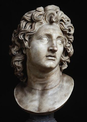
Alexander the Great (Greek: Ἀλέξανδρος ὁ Μέγας or Μέγας Ἀλέξανδρος,[1] Mégas Aléxandros; 356 BC – 323 BC),[2] also known as Alexander III of Macedon (Ἀλέξανδρος Γ' ὁ Μακεδών) was an ancient Greek[3] King (basileus) of Macedon (336–323 BC). He was one of the most successful military commanders of all time and is presumed undefeated in battle. By the time of his death, he had conquered (see Wars of Alexander the Great) the Achaemenid Persian Empire, adding it to Macedon's European territories; according to some modern writers, this was most of the world as known to the ancient Greeks.[4][5][n 1]

Alexander assumed the kingship of Macedon following the death of his father Philip II, who had unified[6] most of the city-states of mainland Greece under Macedonian hegemony in a federation called the League of Corinth.[7] After reconfirming Macedonian rule by quashing a rebellion of southern Greek city-states and staging a short but bloody excursion against Macedon's northern neighbours, Alexander set out east against the Persian Empire, which he defeated and overthrew. His conquests included Anatolia, the Levant, Egypt, Bactria and Mesopotamia, and he extended the boundaries of his own empire as far as Punjab, India.

Alexander had already made plans prior to his death for military and mercantile expansions into the Arabian peninsula, after which he was to turn his armies to the west (Carthage, Rome and the Iberian Peninsula). His original vision, however, had been to the east, to the ends of the world and the Great Outer Sea, as described by his boyhood tutor and mentor Aristotle.

Alexander integrated many foreigners into his army, leading some scholars to credit him with a "policy of fusion". He also encouraged marriages between his soldiers and foreigners, and he himself went on to marry two foreign princesses.

Alexander died after twelve years of constant military campaigning, possibly a result of malaria, poisoning, typhoid fever, viral encephalitis or the consequences of alcoholism.[8][9] His legacy and conquests lived on long after him and ushered in centuries of Greek settlement and cultural influence over distant areas. This period is known as the Hellenistic period, which featured a combination of Greek, Middle Eastern, Egyptian and Indian culture. Alexander himself featured prominently in the history and myth of both Greek and non-Greek cultures. His exploits inspired a literary tradition in which he appeared as a legendary hero in the tradition of Achilles.[10]
Early life"The night before the consummation of their marriage, she dreamed that a thunderbolt fell upon her body, which kindled a great fire, whose divided flames dispersed themselves all about, and then were extinguished. And Philip, some time after he was married, dreamt that he sealed up his wife's body with a seal, whose impression, as be fancied, was the figure of a lion. Some of the diviners interpreted this as a warning to Philip to look narrowly to his wife; but Aristander of Telmessus, considering how unusual it was to seal up anything that was empty, assured him the meaning of his dream was that the queen was with child of a boy, who would one day prove as stout and courageous as a lion."
Plutarch describing Olympias and Philip's dreams.[11]


Alexander was born in July 356 BC, in Pella, the capital of the Kingdom of Macedon. He was the son of King Philip II, the King of Macedon. His mother was Olympias, the daughter of Neoptolemus I, the king of the north Greek state of Epirus. According to Plutarch, Alexander's father claimed descent from Heracles through Caranus of Macedon and his mother from Aeacus through Neoptolemus and Achilles.[12]

According to the ancient Greek historian Plutarch, Olympias, on the eve of the consummation of her marriage to Philip, dreamed that her womb was struck by a thunder bolt, causing a flame which spread "far and wide" before dying away. Some time after the marriage Philip was said to have seen himself, in a dream, sealing up his wife's womb with a seal upon which was engraved the image of a lion. [13] Plutarch offers a variety of interpretations of these dreams; that Olympia was pregnant before her marriage, indicated by the sealing of her womb; or that Alexander's father was Zeus. Ancient commentators were divided as to whether the ambitious Olympias promulgated the story of Alexander's divine parentage, some claiming she told Alexander, others that she dismissed the suggestion as impious.

On the day that Alexander was born, Philip was preparing himself for his siege on the Greek colony of Potidea, which bordered Macedon. On the day that Alexander was born, Philip also received news that his general Parmenion had defeated the combined Illyrian and Paeonian armies and that his horses had won at the Olympic Games. It was also said that on this day, the Temple of Artemis in Ephesus -one the Seven Wonders of the World- was burnt leading Hegesias of Magnesia to say that it burnt because Artemis was attending the birth of Alexander.[14]

In his early years, Alexander was raised by his nurse, Lanike (Lanike was the sister of Alexander's future general, Cleitus the Black). Later on in his childhood, Alexander was tutored by the strict Leonidas, a relative of his mother's uncle and by Lysimachus.[15]

When Alexander was ten years old, a horse trader from Thessaly (a region of Greece to the south of Macedon famed for their horsemanship), brought Philip a horse which he offered to sell for thirteen talents. The horse refused to be mounted by anyone and Philip ordered it to be taken away. Alexander, however, asked for a turn to tame the horse and eventually managed to mount the horse and Philip bought it for him. Alexander would name the horse Bucephalus, meaning ox-head, and take him all the way to India.[16]
 
A bust depicting Philip II of Macedon, Alexander's father

When Alexander was thirteen years old, Philip decided that Alexander needed a higher education and he began to search for a tutor. Many people were passed over including Isocrates and Speusippus, Plato's successor at the Academy of Athens, who offered to resign to take up the post. Philip offered the job to Aristotle, a former pupil of Plato's, who had left Athens to live at Lesbos. Aristotle accepted and Philip gave them as their classroom the Temple of the Nymphs at Mieza. In return for teaching Alexander, Aristole's payment was that Philip rebuild Aristotle's hometown of Stageira, which Philip had razed, and that he repopulate it by buying and freeing the citizens who were slaves or pardoning those who were in exile.[17]

Mieza acted like a boarding school for Alexander and the other noble children, like Ptolemy and Cassander that joined him there. Most of the children that were with Alexander there would be his future friends and generals. At Mieza, Artistotle taught and discussed with Alexander and his companions about healing, biology, philosophy, happiness, religion, classification, logic and art. It was also from Aristotle that Alexander got his undying love for the works of Homer and in particular the Iliad, with Aristotle giving him an annotated copy which he would take with him on campaign.[17]

Regent

When Alexander became sixteen years old his lessons with Aristotle stopped. When Philip departed to attack the city of Byzantium, the sixteen year old Alexander was left as regent of the kingdom. During Philip's absence, the Thracian Maedi tribe revolted against Macedon. Alexander responded quickly and crushed the Maedi insurgence and drove them from their region and colonised it with Greeks and founded a city call Alexandroupolis.[18]

Following Philip's return from Byzantium, he was sent with a small force to subdue some revolts in southern Thrace. He was also said to have saved his father's life during the siege of the Greek city of Perinthus. Meanwhile, the city of Amphissa began to plough the lands that were sacred to the God Apollo near Delphi. Still occupied in Thrace, Philip ordered Alexander to muster a force but to stop intervention from other Greek states make it look like he was attacking Illyria. When the Illyrians heard of his they attacked Macedon but once again Alexander repelled the invaders.[19]

Battle of Chaeronea
Main article: Battle of Chaeronea

Philip joined Alexander with his army in 338 BC and they marched down through Thermopylae, which they took with a struggle from its Theban garrison and went on to occupy the city of Elatia, a few days march from both Athens and Thebes. Meanwhile, the Athenians led by Demosthenes voted for an alliance with Thebes in opposition to Macedon. Both Athens and Macedon sent embassies to Thebes in order to win Thebes' favour with Athens eventually gaining the alliance.[20]

Philip carried out the mission appointed to him by the Sacred League and marched on Amphissa, captured the mercenaries sent there by Demosthenes and accepted the city's surrender. Philip retreated back to Elatea and sent a final offer of peace to Athens and Thebes which was rejected.[21]
 
Battle plan of the Battle of Chaeronea

The Macedonian army of 30,000 infantry and 3,000 cavalry met the united Greek army of 30,000 men at Chaeronea in Boeotia. Philip commanded the Macedonian right and he gave Alexander command of the elite, Companion Cavalry on the left flank to counter the elite Theban Sacred Band on the Greek left flank, while Philip faced the Athenians lead by the inexperienced Demosthenes.[21]

Philip managed to draw the Athenian left flank out of its defense position on a slope by feigning retreat. This also drew the Athenian centre from their position and they advanced to attack Philip. Alexander exploited this opportunity and charged the gap between the Thebans and the Athenian centre. Following some strong resistance, Alexander managed to route the Theban and slaughter the Sacred Band to the last man before attacking the Athenian centre. Philip's men broke the Athenian right and they attacked Athenian centre at the same time as Alexander making it break a flee.[21]

Philip sold the captured Theban soldiers as slaves before establishing a garrison in Thebes and executing or banishing some of the city's anti-Macedonian leaders. From Thebes, he went to Athens were he gave them their captured soldiers back without a ransom. Philip and Alexander marched unopposed into the Peloponnese and at Corinth, Philip was named 'Supreme Commander' of the Greek forces by the League of Corinth, a federation of all the Greek states except for Sparta, in his planned war against the Persia Empire.[22]

Exile and return"At the wedding of Cleopatra, whom Philip fell in love with and married, she being much too young for him, her uncle Attalus in his drink desired the Macedonians would implore the gods to give them a lawful successor to the kingdom by his niece. This so irritated Alexander, that throwing one of the cups at his head, "You villain," said he, "what, am I then a bastard?" Then Philip, taking Attalus's part, rose up and would have run his son through; but by good fortune for them both, either his over-hasty rage, or the wine he had drunk, made his foot slip, so that he fell down on the floor. At which Alexander reproachfully insulted over him: "See there," said he, "the man who makes preparations to pass out of Europe into Asia, overturned in passing from one seat to another."
Plutarch describing the feud at Philip's wedding.[23]


After returning to Pella, Philip fell in love with a young Macedonian noblewoman by the name of Cleopatra Eurydice, the niece of one of his generals, Attalus. This marriage made Alexander position as heir to the throne less secure as if Cleopatra Eurydice bore a son by Philip, the son would be full Macedonian while Alexander was only half Macedonian.[24]

During the banquet after Philip's wedding to Cleopatra Eurydice, a drunken Attalus made a speech praying to the gods that the union would produce a legitimate heir to the Macedonian throne. Alexander shouted to Attalus, "What, am I then a bastard?"[13] and he threw his goblet at him. Philip who was also drunk drew his sword and advanced towards Alexander before collapsing leading Alexander to say, "See there," said he, "the man who makes preparations to pass out of Europe into Asia, overturned in passing from one seat to another."[13][25]

Alexander fled from Macedon taking his mother with him. He dropped off his mother at her brother's capital, Dodona, in Epirus before he went to Illyria where he sought refuge with the Illyrian King and was treated like a guest by the Illyrians despite having defeated them in battle a few years before. Alexander returned to Macedon after six months in exile due to the efforts of a family friend, Demaratus the Corinthian, who mediated between the two parties.[26]

The following year, the Persian satrap (governor) of Caria in Asia Minor, Pixodarus, offered the hand of his eldest daughter to Philip's mentally and physically disabled son, Philip Arrhidaeus. Olympias and several of Alexander's friends had it seem that this move showed that Philip intended to make Arrhidaeus, his heir. Alexander reacted by sending an actor, Thessalus from Corinth, to tell Pixodarus that he should not offer his daughter's hand to an illegitimate son but instead to Alexander. When Philip heard of this, he scolded Alexander for wishing to marry the daughter of Carian. Philip had four of Alexander's friends, Harpalus, Nearchus, Ptolemy and Erygius exiled and had the Corinthians bring Thessalus to him in chains.[27]

Accession
 
The Kingdom of Macedon in 336 BC

In 336 BC, while attending the wedding of his daughter by Olympias, Cleopatra and Olympias' brother, Alexander I of Epirus at Aegae, Philip was assassinated by the captain of his bodyguard, Pausanias, who reportedly had a grudge against Philip, who was his former lover.i[›] As Pausanias tried to escape he tripped over a vine and was killed by his pursuers, including two of Alexander's friends Perdiccas and Leonnatus. Alexander was proclaimed King by the Macedonian army and by the Macedonian noblemen at the age of 20. [28]

Alexander began his reign by having his potential rivals to the throne murdered. He had his cousin, the former Amyntas IV, executed, as well as having two Macedonian princes from the region of Lyncestis killed, while a third, Alexander Lyncestes, was spared. Olympias had Cleopatra Eurydice and her daughter by Philip, Europa, burned alive. When Alexander found out about this, he was furious with his mother. Alexander also ordered the murder of Attalus, who was in command of the advance guard of the army in Asia Minor. Attalus was at the time in correspondence with Demosthenes with intentions of defection to Athens. Alexander also spared the life of his half brother Arridaeus.[28]

News of Philip's death roused many states into revolt including Thebes, Athens, Thessaly and the Thracian tribes to the north of Macedon. When news of the revolt reached Alexander he responded quickly. Though his advisor's advised him to use diplomacy, Alexander mustered the Macedonian cavalry of 3,000 men and rode south towards Thessaly, Macedon's immediate neighbor to the south. When he found the Thessalian army occupying the pass between Mount Olympus and Mount Ossa, he had the men ride through Mount Ossa and, when the Thessalians awoke, they found Alexander at their rear. The Thessalians surrendered and added their cavalry to Alexander's force as he rode down towards the Peloponnese.[29]

Alexander stopped at Thermopylae, where he was recognised as the leader of the Sacred League before heading south to Corinth. Athens sued for peace and Alexander received the envoy and pardoned anyone involved with the uprising. At Corinth, he was given the title 'Hegemon' of the Greek forces against the Persians. While at Corinth, he heard the news of the Thracian rising to the north.[30]

Balkan Campaign

Before crossing to Asia, Alexander wanted to safeguard his northern borders and, in the spring of 335 BC, he advanced into Thrace to deal with the revolt, which was led by the Illyrians and Triballi. He was reinforced along the way by the Agriani, a Thracian tribe under the command of Alexander's friend, Langarus. The Macedonian army marched up to Mount Haemus, where they met a Thracian garrison manning the heights. The Thracians had constructed a palisade of carts, which they intended to throw upon the approaching Macedonians. Alexander ordered his heavy infantry to march in loose formation and, when the carts were thrown, to either open the ranks or lay flat on the ground with their shields over them. The Macedonian archers opened fire and when the Macedonian infantry reached the top of the mountain they routed the Thracians.[31]

Meanwhile, a large Triballian army led by their king, Syrmus, advanced upon the Macedonian rear. The Triballians retreated to a gorge, where they were drawn out by Alexander's light infantry. On the open ground, they were crushed by Alexander's infantry and cavalry, leaving behind 3,000 dead. The Macedonians marched to the Danube River where they encountered the Getae tribe on the opposite shore. As Alexander's ships failed to enter the river, Alexander's army made rafts out of their leather tents. A force of 4,000 infantry and 1,500 cavalry crossed the river, to the amazement of the Getae army of 14,000 men. The Getae army retreated after the first cavalry skirmish, leaving their town to the Macedonian army.[32]

News reached Alexander that Cleitus, King of Illyria, and King Glaukias of the Taulanti were in open revolt against Macedonian authority. Alexander and his men started to besiege the Illyrians in a hill fort, Pelium. The following day, Glaukias arrived with his army to relieve the town. Philotas, one of Alexander's friends and generals, was trapped by the Taulanti while foraging. When Alexander heard of his friend's predicament he rushed in with his army and managed to frighten Glaukias off attacking Philotas.[33]

Alexander and his army were trapped between the Illyrians and the Taulanti, who each held high ground. When Alexander's army moved towards the Taulanti threat, yelling their war cries, the Taulanti fled from the heights and went into the town. After noticing Pelium's lack of defenses, Alexander feigned a retreat, and, in the night, stormed the town, forcing Cleitus and Glaukias to flee with their armies, leaving Alexander's northern frontier secure.[34]

While he was triumphantly campaigning north, the Thebans and Athenians rebelled once more. Alexander reacted immediately, but, while the other cities once again hesitated, Thebes decided to resist with the utmost vigor. This resistance was useless, however, as the city was razed to the ground amid great bloodshed and its territory divided between the other Boeotian cities. Moreover, the Thebans themselves were sold into slavery.[35] Alexander spared only priests, leaders of the pro-Macedonian party and descendants of Pindar, whose house was the only one left standing. The end of Thebes cowed Athens into submission. According to Plutarch, a special Athenian embassy, led by Phocion, an opponent of the anti-Macedonian faction, was able to persuade Alexander to give up his demand for the exile of leaders of the anti-Macedonian party, most particularly Demosthenes.[36]

Period of conquests
Main article: Wars of Alexander the Great

By the time of his death, Alexander had conquered most of the Ecumene, the extension of the "known world" at the time of ancient Greeks,[4] concretely he conquered the extensions lying to the south and east of Greece, including places not explored until then.[5][n 1]

Fall of the Achaemenid Persian Empire
 
Map of Alexander's empire and the paths he took

Alexander's army crossed the Hellespont with approximately 42,000 soldiers from Macedon, various Greek city-states, mercenaries and tribute soldiers from Thrace, Paionia, and Illyria. After an initial victory against Persian forces at the Battle of the Granicus, Alexander accepted the surrender of the Persian provincial capital and treasury of Sardis and proceeded down the Ionian coast. At Halicarnassus, Alexander successfully waged the first of many sieges, eventually forcing his opponents, the mercenary captain Memnon of Rhodes and the Persian satrap of Caria, Orontobates, to withdraw by sea. Alexander left Caria in the hands of Ada, who was ruler of Caria before being deposed by her brother Pixodarus. From Halicarnassus, Alexander proceeded into mountainous Lycia and the Pamphylian plain, asserting control over all coastal cities and denying them to his enemy. From Pamphylia onward, the coast held no major ports and so Alexander moved inland. At Termessos, Alexander humbled but did not storm the Pisidian city. At the ancient Phrygian capital of Gordium, Alexander "undid" the hitherto unsolvable Gordian Knot, a feat said to await the future "king of Asia." According to the most vivid story, Alexander proclaimed that it did not matter how the knot was undone, and he hacked it apart with his sword.[37] Another version claims that he did not use the sword, but realized that the simplest way to undo the knot was to simply remove a central peg from the chariot—around which the knot was tied.
 
Alexander Mosaic, showing Battle of Issus, from the House of the Faun, Pompeii

Alexander's army crossed the Cilician Gates, met and defeated the main Persian army under the command of Darius III at the Battle of Issus in 333 BC. Darius was forced to flee the battle after his army broke, and in doing so left behind his wife, his two daughters, his mother Sisygambis, and a fabulous amount of treasure. He afterwards offered a peace treaty to Alexander, the concession of the lands he had already conquered, and a ransom of 10,000 talents for his family. Alexander replied that since he was now king of Asia, it was he alone who decided territorial divisions. Proceeding down the Mediterranean coast, he took Tyre and Gaza after famous sieges (see Siege of Tyre) suffered the most brutal attacks during Alexander's war in Asia.[38][39] It was after his capture of Tyre that Alexander crucified all the men of military age, and sold the women and children into slavery.[40]

During 332–331 BC, Alexander was welcomed as a liberator[41] in an Egypt ruled by Persians and was pronounced the new Master of the Universe[42] and son of Zeus[citation needed] by Egyptian priests of the deity Amun[42] at the Oracle of Siwa Oasis in the Libyan desert. Henceforth, Alexander often referred to Zeus-Ammon as his true father, and subsequent currency depicted him, adorned with ram horns as a symbol of his divinity.[43] He founded Alexandria in Egypt, which would become the prosperous capital of the Ptolemaic dynasty after his death. Leaving Egypt, Alexander marched eastward into Assyria (now northern Iraq) and defeated Darius once more at the Battle of Gaugamela. Once again, Darius was forced to leave the field, and Alexander chased him as far as Arbela. While Darius fled over the mountains to Ecbatana (modern Hamedan), Alexander marched to Babylon.

From Babylon, Alexander went to Susa, one of the Achaemenid capitals, and captured its legendary treasury. Sending the bulk of his army to the Persian capital of Persepolis via the Royal Road, Alexander stormed and captured the Persian Gates (in the modern Zagros Mountains), then sprinted for Persepolis before its treasury could be looted. It was here that Alexander was said to have stared at the crumbled statue of Xerxes and decided to leave it on the ground—a symbolic gesture of vengeance. During their stay at the capital, a fire broke out in the eastern palace of Xerxes and spread to the rest of the city. Theories abound as to whether this was the result of a drunken accident, or a deliberate act of revenge for the burning of the Acropolis of Athens during the Second Persian War. The Book of Arda Wiraz, a Zoroastrian work composed in the 3rd or 4th century AD, also speaks of archives containing "all the Avesta and Zand, written upon prepared cow-skins, and with gold ink" that were destroyed; but it must be said that this statement is often treated by scholars with a certain measure of skepticism, because it is generally thought that for many centuries the Avesta was transmitted mainly orally by the Magi.
 
Statuette of a Greek soldier, from a 4th–3rd century BC burial site north of the Tian Shan, at the maximum extent of Alexander's advance in the East (Ürümqi, Xinjiang Museum, China) (drawing)

Alexander then set off in pursuit of Darius anew. The Persian king was no longer in control of his destiny, having been taken prisoner by Bessus, his Bactrian satrap and kinsman. As Alexander approached, Bessus had his men fatally stab the Great King and then declared himself Darius' successor as Artaxerxes V before retreating into Central Asia to launch a guerrilla campaign against Alexander. Darius was found by one of Alexander's scouts, dying, in a baggage train being pulled by an ox. Before he died, Darius remarked that he was glad that he would not die alone. His remains were buried by Alexander next to his Achaemenid predecessors in a full military funeral.[44] Alexander claimed that, while dying, Darius had named Alexander as his successor to the Achaemenid throne, a striking irony since it was Alexander who had pursued him to his death. Alexander, viewing himself as the legitimate Achaemenid successor to Darius, viewed Bessus as a usurper to the Achaemenid throne, and eventually found and executed this 'usurper'. The majority of the existing satraps were to give their loyalty to Alexander, and be allowed to keep their positions. Alexander, now the Persian "King of Kings", adopted Persian dress and mannerisms, which, in time, the Greeks began to view as decadent and autocratic. They began to fear that Alexander was turning into an eastern despot. Ultimately, however, the Achaemenid Persian Empire is considered to have fallen with the death of Darius. With the death of Darius, Alexander declared the war of vengeance over, and released his Greek and other allies from service in the League campaign (although he allowed those that wished to re-enlist as mercenaries in his army).

His three-year campaign, first against Bessus and then against Spitamenes, the satrap of Sogdiana, took Alexander through Media, Parthia, Aria (West Afghanistan), Drangiana, Arachosia (South and Central Afghanistan), Bactria (North and Central Afghanistan), and Scythia. In the process of doing so, he captured and refounded Herat and Maracanda. Moreover, he founded a series of new cities, all called Alexandria, including modern Kandahar in Afghanistan, and Alexandria Eschate ("The Furthest") in modern Tajikistan. In the end, both of his opponents were defeated after having been betrayed by their men—Bessus in 329 BC, and Spitamenes the year after.

Hostility

During this time, Alexander adopted some elements of Persian dress and customs at his court, notably the custom of proskynesis, a symbolic kissing of the hand that Persians paid to their social superiors, but a practice that the Greeks disapproved. The Greeks regarded the gesture as the province of deities and believed that Alexander meant to deify himself by requiring it. This cost him much in the sympathies of many of his countrymen. Here, too, a plot against his life was revealed, and one of his officers, Philotas, was executed for failing to bring the plot to his attention. The death of the son necessitated the death of the father, and thus Parmenion, who had been charged with guarding the treasury at Ecbatana, was assassinated by command of Alexander, so he might not make attempts at vengeance. Most infamously, Alexander personally slew the man who had saved his life at Granicus, Cleitus the Black, during a drunken argument at Maracanda.[45] Later in the Central Asian campaign, a second plot against his life was revealed, this one instigated by his own royal pages. His official historian, Callisthenes of Olynthus (who had fallen out of favor with the king by leading the opposition to his attempt to introduce proskynesis), was implicated in the plot, however, there never has been consensus among historians regarding his involvement in the conspiracy.

The Persians referred to Alexander’s castle in Persia as the "Kelah-i-Dive-Sefid" meaning Castle of the White Demon[46] with Alexander representing the Div-e Sepid of the Shahnameh epic.

Invasion of India
See also: Alexander's Conflict with the Kambojas and Battle of the Hydaspes
 
Campaigns and landmarks of Alexander's invasion of Southern Asia.

After the death of Spitamenes and his marriage to Roxana (Roshanak in Bactrian) to cement his relations with his new Central Asian satrapies, in 326 BC Alexander was finally free to turn his attention to the Indian subcontinent. Alexander invited all the chieftains of the former satrapy of Gandhara, in the north of what is now Pakistan, to come to him and submit to his authority. Ambhi (Greek: Omphis), ruler of Taxila, whose kingdom extended from the Indus to the Jhelum (Greek:Hydaspes), complied. But the chieftains of some hill clans including the Aspasioi and Assakenoi sections of the Kambojas (classical names), known in Indian texts as Ashvayanas and Ashvakayanas (names referring to the equestrian nature of their society from the Sanskrit root word Ashva meaning horse), refused to submit.

Alexander personally took command of the shield-bearing guards, foot-companions, archers, Agrianians and horse-javelin-men and led them against the clans—the Aspasioi of Kunar/Alishang valleys, the Guraeans of the Guraeus (Panjkora) valley, and the Assakenoi of the Swat and Buner valleys. Writes one modern historian: "They were brave people and it was hard work for Alexander to take their strongholds, of which Massaga and Aornus need special mention."[47][48] A fierce contest ensued with the Aspasioi in which Alexander himself was wounded in the shoulder by a dart but eventually the Aspasioi lost the fight; 40,000 of them were enslaved. The Assakenoi faced Alexander with an army of 30,000 cavalry, 38,000 infantry and 30 elephants.[49] They had fought bravely and offered stubborn resistance to the invader in many of their strongholds like cities of Ora, Bazira and Massaga. The fort of Massaga could only be reduced after several days of bloody fighting in which Alexander himself was wounded seriously in the ankle. When the Chieftain of Massaga fell in the battle, the supreme command of the army went to his old mother Cleophis (q.v.) who also stood determined to defend her motherland to the last extremity. The example of Cleophis assuming the supreme command of the military also brought the entire women of the locality into the fighting.[50][51] Alexander could only reduce Massaga by resorting to political strategem and actions of betrayal. According to Curtius: "Not only did Alexander slaughter the entire population of Massaga, but also did he reduce its buildings to rubbles." A similar slaughter then followed at Ora, another stronghold of the Assakenoi.
 
A painting by Charles Le Brun depicting Alexander and Porus (Puru) during the Battle of the Hydaspes

In the aftermath of general slaughter and arson committed by Alexander at Massaga and Ora, numerous Assakenians people fled to a high fortress called Aornos. Alexander followed them close behind their heels and captured the strategic hill-fort but only after the fourth day of a bloody fight. The story of Massaga was repeated at Aornos and a similar carnage of the tribal-people followed here too.

Writing on Alexander's campaign against the Assakenoi, Victor Hanson comments: "After promising the surrounded Assacenis their lives upon capitulation, he executed all their soldiers who had surrendered. Their strongholds at Ora and Aornus were also similarly stormed. Garrisons were probably all slaughtered.”[52]

Sisikottos, or Sashigupta who had helped Alexander in this campaign, was made the governor of Aornos. According to H. C. Seth and Ranajit Pal, he was the same as Chandragupta Maurya. After reducing Aornos, Alexander crossed the Indus and fought and won an epic battle against a local ruler Porus (original Indian name Raja Puru), who ruled a region in the Punjab, in the Battle of Hydaspes in 326 BC.
 
Silver coin of Alexander (336-323 BCE). British Museum.

After the battle, Alexander was greatly impressed by Porus for his bravery in battle, and therefore made an alliance with him and appointed him as satrap of his own kingdom, even adding some land he did not own before. Alexander then named one of the two new cities that he founded, Bucephala, in honor of the horse who had brought him to India, who had died during the Battle of Hydaspes.[53] Alexander continued on to conquer all the headwaters of the Indus River.

East of Porus' kingdom, near the Ganges River (original Indian name Ganga), was the powerful Nanda Empire of Magadha and Gangaridai Empire of Bengal. Fearing the prospects of facing other powerful Indian armies and exhausted by years of campaigning, his army mutinied at the Hyphasis River (the modern Beas River) refusing to march further east. This river thus marks the easternmost extent of Alexander's conquests:

As for the Macedonians, however, their struggle with Porus blunted their courage and stayed their further advance into India. For having had all they could do to repulse an enemy who mustered only twenty thousand infantry and two thousand horse, they violently opposed Alexander when he insisted on crossing the river Ganges also, the width of which, as they learned, was thirty-two furlongs, its depth a hundred fathoms, while its banks on the further side were covered with multitudes of men-at-arms and horsemen and elephants. For they were told that the kings of the Ganderites and Praesii were awaiting them with eighty thousand horsemen, two hundred thousand footmen, eight thousand chariots, and six thousand fighting elephants.
—Plutarch , Vita Alexandri, 62[54]

Gangaridai, a nation which possesses a vast force of the largest-sized elephants. Owing to this, their country has never been conquered by any foreign king: for all other nations dread the overwhelming number and strength of these animals. [Thus Alexander the Macedonian, after conquering all Asia, did not make war upon the Gangaridai, as he did on all others; for when he had arrived with all his troops at the river Ganges, and had subdued all the other Indians, he abandoned as hopeless an invasion of the Gangaridai when he learned that they possessed four thousand elephants well trained and equipped for war. ]"---Megasthenes (c. 350 BC-290 BC). Quoted from the Epitome of Megasthenes, Indika. (Diod. II. 35-42. ), Ancient India as Described by Megasthenes and Arrian. Translated and edited by J. W. McCrindle.
 
Ptolemy coin with Alexander wearing an elephant scalp, symbol of his conquests in India.

Alexander spoke to his army and tried to persuade them to march further into India but Coenus pleaded with him to change his opinion and return, the men, he said, "longed to again see their parents, their wives and children, their homeland". Alexander, seeing the unwillingness of his men agreed and turned south. Along the way his army conquered the Malli clans (in modern day Multan), reputed to be among the bravest and most warlike peoples in South Asia. During a siege, Alexander jumped into the fortified city alone with only two of his bodyguards and was wounded seriously by a Mallian arrow.[55] His forces, believing their king dead, took the citadel and unleashed their fury on the Malli who had taken refuge within it, perpetrating a massacre, sparing no man, woman or child.[56] However, due to the efforts of his surgeon, Kritodemos of Kos, Alexander survived the injury.[57] Following this, the surviving Malli surrendered to Alexander's forces, and his beleaguered army moved on, conquering more Indian tribes along the way. He sent much of his army to Carmania (modern southern Iran) with his general Craterus, and commissioned a fleet to explore the Persian Gulf shore under his admiral Nearchus, while he led the rest of his forces back to Persia by the southern route through the Gedrosian Desert (now part of southern Iran and Makran now part of Pakistan).

In the territory of the Indus, he nominated his officer Peithon as a satrap, a position he would hold for the next ten years until 316 BC, and in the Punjab he left Eudemus in charge of the army, at the side of the satrap Porus and Taxiles. Eudemus became ruler of a part of the Punjab after their death. Both rulers returned to the West in 316 BC with their armies. In 321 BCE, Chandragupta Maurya founded the Maurya Empire in India and overthrew the Greek satraps.

After India
 
Statuette of the young Alexander astride a horse, Begram, Afghanistan.

Discovering that many of his satraps and military governors had misbehaved in his absence, Alexander executed a number of them as examples on his way to Susa. As a gesture of thanks, he paid off the debts of his soldiers, and announced that he would send those over-aged and disabled veterans back to Macedonia under Craterus, but his troops misunderstood his intention and mutinied at the town of Opis, refusing to be sent away and bitterly criticizing his adoption of Persian customs and dress and the introduction of Persian officers and soldiers into Macedonian units. Alexander executed the ringleaders of the mutiny, but forgave the rank and file. In an attempt to craft a lasting harmony between his Macedonian and Persian subjects, he held a mass marriage of his senior officers to Persian and other noblewomen at Susa, but few of those marriages seem to have lasted much beyond a year. Meanwhile, upon his return, Alexander learned some men had desecrated the tomb of Cyrus the Great, and swiftly executed them. For they were put in charge of guarding the tomb Alexander held in honor.

His attempts to merge Persian culture with his Greek soldiers also included training a regiment of Persian boys in the ways of Macedonians. Most historians believe that Alexander adopted the Persian royal title of Shahanshah (meaning: "The King of Kings").

It is claimed that Alexander wanted to overrun or integrate the Arabian peninsula, but this theory is widely disputed. It was assumed that Alexander would turn westwards and attack Carthage and Italy, had he conquered Arabia.

After traveling to Ecbatana to retrieve the bulk of the Persian treasure, his closest friend and possibly lover[58] Hephaestion died of an illness, or possibly of poisoning. Alexander, distraught over the death of his longtime companion, sacked a nearby town, and put all of its inhabitants to the sword, as a 'sacrifice' to Hephaestion's ghost. Alexander mourned Hephaestion for six months.

Death
 
Alexander's Empire at his death in 323 BC.

On the afternoon of June 11, 323 BC, Alexander died in the palace of Nebuchadnezzar II of Babylon. He was one month short of 33 years of age. Various theories have been proposed for the cause of his death which include poisoning by the sons of Antipater or others, sickness that followed a drinking party, or a relapse of the malaria he had contracted in 336 BC.[59]

It is known that on May 29, Alexander participated in a banquet organized by his friend Medius of Larissa. After some heavy drinking, immediately before or after a bath, he was forced into bed due to severe illness. The rumors of his illness circulated with the troops causing them to be more and more anxious. On June 9, the generals decided to let the soldiers see their king alive one last time. They were admitted to his presence one at a time. Because the king was too ill to speak, he confined himself to moving his hand. Plutarch records that on the same day, Python and Seleucus went to the Temple of the God Serapis and inquired of the God if Alexander should be moved there, yet the God replied that Alexander should remain where he was. [60] It is quite plausible that this event did indeed occur; however, it should be borne in mind that Plutarch was writing several centuries after the events themselves. Thus, it is possible that such a tale developed over time as an allegory for the breakup of Alexander's Empire. (The God Serapis replied that Alexander should remain in his palace in Babylon, which he had made the capital of his Empire. Hence, the Empire died with Alexander, which was indeed the case, divided as noted below among his generals.) At all events, what is certain is that on June 11, Alexander was dead.[59]

Cause

The poisoning theory derives from the story held in antiquity by Justin and Curtius. The original story stated that Cassander, son of Antipater, viceroy of Greece, brought the poison to Alexander in Babylon in a mule's hoof, and that Alexander's royal cupbearer, Iollas, brother of Cassander and eromenos of Medius of Larissa, administered it.[61] Many had powerful motivations for seeing Alexander gone, and were none the worse for it after his death. Deadly agents that could have killed Alexander in one or more doses include hellebore and strychnine. In R. Lane Fox's opinion, the strongest argument against the poison theory is the fact that twelve days had passed between the start of his illness and his death and in the ancient world, such long-acting poisons were probably not available. However, according to Unearthing Ancient Secrets, it might still have been possible if Alexander was poisoned first with hellebore during his drink, then later have been poisoned a second or third time, perhaps with poison on the feather used to encourage vomiting. [62]
 
Coin of Alexander the Great, depicting Athena in profile, and a standing Nike.

The warrior culture of Macedon favoured the sword over strychnine, and many ancient historians, like Plutarch and Arrian, maintained that Alexander was not poisoned, but died of natural causes; malaria or typhoid fever, which were rampant in ancient Babylon. A 1998 article in the New England Journal of Medicine attributed his death to typhoid fever complicated by bowel perforation and ascending paralysis,[63] whereas a recent analysis has identified pyogenic spondylitis or meningitis.[64] Other illnesses could have also been the culprit, including acute pancreatitis or the West Nile virus.[9] The West Nile virus theory holds sway because the symptoms match up, Alexander had been trekking through swamps prior to getting ill, and an ancient account of birds pecking each other in the air seen on Alexander's approach into Babylon, which was at the time seen as a bad omen, but could have also been the result of infected birds.[62] Recently, theories have been advanced stating that Alexander may have died from the treatment not the disease. Hellebore, believed to have been widely used as a medicine at the time but deadly in large doses, may have been overused by the impatient king to speed his recovery, with deadly results. Disease-related theories often cite the fact that Alexander's health had fallen to dangerously low levels after years of heavy drinking and suffering several appalling wounds (including one in India that nearly claimed his life), and that it was only a matter of time before one sickness or another finally killed him.[62]

Physical deformity and the cause of death

More recently Alexander’s physical characteristics have been combined with the information of his final days to arrive at the cause of his death. Many descriptions and statues typically portray Alexander with a cervical neck deformity, typically with a gaze looking upward and outward (an image still used in modern day heroic photography). Both his father Philip II and his brother Philip Arridaeus also suffered from physical deformities, leading some to suggest a congenital scoliotic disorder (familial neck and spinal deformity).[64] A familial scoliotic deformity has therefore been ascribed as the cause of his death by means of an ascending spinal infection (pyogenic spondylitis or meningitis),[64] which would also explain the ascending spinal paralysis in his final days. Furthermore, such a condition has also been proposed as a potential cause for Alexander’s depictions with horns by way of a scoliosis associated neurocutaneous Epidermal Nevus Syndrome.[citation needed]

No story is conclusive. Alexander's death has been reinterpreted many times over the centuries. What is certain is that Alexander died of a high fever on June 11, 323 BC.[65]

Successor
 
An Astronomical diary from the year 323–322 BC that records the death of Alexander. Located at the British Museum, London

On his death bed, his marshals asked him to whom he bequeathed his kingdom. Since Alexander had no obvious and legitimate heir (his son Alexander IV would be born after his death, and his other son was by a concubine, not a wife), it was a question of vital importance. There is some debate to what Alexander replied. Some believe that Alexander said, "Kratisto" (that is, "To the strongest!") or "Krat'eroi" (to the stronger).

Alexander may have said, "Krater'oi" (to Craterus). This is possible because the Greek pronunciation of "the stronger" and "Craterus" differ only by the position of the accented syllable. Most scholars believe that if Alexander did intend to choose one of his generals, his obvious choice would have been Craterus because he was the commander of the largest part of the army (infantry), had proven himself to be an excellent strategist, and because he displayed traits of the "ideal" Macedonian. But Craterus was not around, and the others may have chosen to hear "Krat'eroi" — the stronger. Regardless of his reply, Craterus does not appear to have pressed the issue. The empire then split amongst his successors (the Diadochi).

Before long, accusations of foul play were being thrown about by his generals at one another, and no contemporaneous source can be fully trusted.

Body

Alexander's body was placed in a gold anthropoid sarcophagus, which was in turn placed in a second gold casket and covered with a purple robe. Alexander's coffin was placed, together with his armour, in a gold carriage that had a vaulted roof supported by an Ionic peristyle. The decoration of the carriage was very lavish and is described in great detail by Diodoros.
 
A rare coin of Ptolemy I, showing himself on the obverse at the beginning of his reign, and on the reverse Alexander the Great triumphantly riding a chariot drawn by elephants, a reminder of his successful campaigns with Alexander in India.

According to one legend, Alexander was preserved in a clay vessel full of honey (which can act as a preservative) and interred in a glass coffin. According to Aelian (Varia Historia 12.64), Ptolemy stole the body and brought it to Alexandria, where it was on display until Late Antiquity. It was here that Ptolemy IX, one of the last successors of Ptolemy I, replaced Alexander's sarcophagus with a glass one, and melted the original down in order to strike emergency gold issues of his coinage. The citizens of Alexandria were outraged at this and soon after, Ptolemy IX was killed.

The Roman emperor Caligula was said to have looted the tomb, stealing Alexander's breastplate, and wearing it. Around 200 AD, Emperor Septimius Severus closed Alexander's tomb to the public. His son and successor, Caracalla, was a great admirer of Alexander, and visited the tomb in his own reign. After this, details on the fate of the tomb are sketchy.

The so-called "Alexander Sarcophagus," discovered near Sidon and now in the Istanbul Archaeology Museum, is so named, not because it was ever thought to have contained Alexander's remains but because its bas-reliefs depict Alexander and his companions hunting and in battle with the Persians. Originally thought[66] to have been the sarcophagus of Abdalonymus (died 311 BC), the king of Sidon appointed by Alexander immediately following the battle of Issus, 331,[67] some recent opinion makes it earlier than Abdalonymus' death.[68]

Testament

Some classical authors, such as Diodorus, relate that Alexander had given detailed written instructions to Craterus some time before his death. Although Craterus had already started to implement Alexander's orders, such as the building of a fleet in Cilicia for expedition against Carthage, Alexander's successors chose not to further implement them, on the grounds that they were impractical and extravagant.[69] The testament, described in Diodorus XVIII, called for military expansion into the Southern and Western Mediterranean, monumental constructions, and the intermixing of Eastern and Western populations. Its most remarkable items were:
The completion of a pyre to Hephaestion
The building of "a thousand warships, larger than triremes, in Phoenicia, Syria, Cilicia, and Cyprus for the campaign against the Carthaginians and the other who live along the coast of Libya and Iberia and the adjoining coastal regions as far as Sicily"
The building of a road in northern Africa as far as the Pillars of Heracles, with ports and shipyards along it.
The erection of great temples in Delos, Delphi, Dodona, Dium, Amphipolis, Cyrnus and Ilium.
The construction of a monumental tomb for his father Philip, "to match the greatest of the pyramids of Egypt"
The establishment of cities and the "transplant of populations from Asia to Europe and in the opposite direction from Europe to Asia, in order to bring the largest continent to common unity and to friendship by means of intermarriage and family ties." (Diodorus Siculus, Bibliotheca historia, XVIII)

Personal life
Main article: Alexander the Great's personal relationships

Alexander's lifelong companion was Hephaestion, the son of a Macedonian noble. Hephaestion also held the position of second-in-command of Alexander's forces until his death, which devastated Alexander. The full extent of his relationship with Hephaestion is the subject of much historical speculation.

Alexander married two women: Roxana, daughter of a Bactrian nobleman, Oxyartes; and Stateira, a Persian princess and daughter of Darius III of Persia. There is also an accepted tradition of a third wife – Parysatis – whom he is supposed to have married in Persia, though nothing else is known about her. Another personage from the court of Darius III with whom he was intimate was the male eunuch Bagoas. His son by Roxana, Alexander IV of Macedon, was killed after the death of his father, before he reached adulthood.

Alexander was admired during his lifetime for treating all his lovers humanely.[70][71]

Legacy and division of the empire
Main article: Diadochi
 
Coin of Alexander bearing an Aramaic language inscription.
 
The Hellenistic world view after Alexander: ancient world map of Eratosthenes (276-194 BC), incorporating information from the campaigns of Alexander and his successors.[72]

After Alexander's death, in 323 BC, the rule of his Empire was given to Alexander's half-brother Philip Arridaeus and Alexander's son Alexander IV. However, since Philip was apparently feeble-minded and the son of Alexander still a baby, two regents were named in Perdiccas (who had received Alexander's ring at his death) and Craterus (who may have been the one mentioned as successor by Alexander), although Perdiccas quickly managed to take sole power.

Perdiccas soon eliminated several of his opponents, killing about 30 (Diodorus Siculus), and at the Partition of Babylon named former generals of Alexander as satraps of the various regions of his Empire. In 321 BC Perdiccas was assassinated by his own troops during his conflict with Ptolemy, leading to the Partition of Triparadisus, in which Antipater was named as the new regent, and the satrapies again shared between the various generals. From that time, Alexander's officers were focused on the explicit formation of rival monarchies and territorial states.

Ultimately, the conflict was settled after the Battle of Ipsus in Phrygia in 301 BC. Alexander's empire was divided at first into four major portions: Cassander ruled in Macedon, Lysimachus in Thrace, Seleucus in Mesopotamia and Persia, and Ptolemy I Soter in the Levant and Egypt. Antigonus ruled for a while in Anatolia and Syria but was eventually defeated by the other generals at Ipsus (301 BC).

Control over Indian territory passed to Chandragupta Maurya, the first Maurya emperor, who further expanded his dominions after a settlement with Seleucus.

By 270 BC, the Hellenistic states were consolidated, with
The Antigonid Empire in Greece;
The Seleucid Empire in Mesopotamia and Persia;
The Ptolemaic Kingdom in Egypt, Palestine and Cyrenaica
 
The Greco-Bactrian king Demetrius (reigned c. 200–180 BCE), wearing an elephant scalp, took over Alexander's legacy in the east by again invading India in 180 BCE, and establishing the Indo-Greek kingdom (180 BC–10 AD).

By the 1st century BC though, most of the Hellenistic territories in the West had been absorbed by the Roman Republic. In the East, they had been dramatically reduced by the expansion of the Parthian Empire. The territories further east seceded to form the Greco-Bactrian kingdom (250–140 BC), which further expanded into India to form the Indo-Greek kingdom (180 BC–10 AD).

The Ptolemy dynasty persisted in Egypt until the epoch of the queen Cleopatra, best known for her alliances with Julius Caesar and Mark Antony, just before the Roman republic officially became the Roman Empire.

Alexander's conquests also had long term cultural effects, with the flourishing of Hellenistic civilization throughout the Middle East and Central Asia, and the development of Greco-Buddhist art in the Indian subcontinent. Alexander and his successors were tolerant of non-Greek religious practices, and interesting syncretisms developed in the new Greek towns he founded in Central Asia. The first realistic portrayals of the Buddha appeared at this time; they are reminiscent of Greek statues of Apollo. Several Buddhist traditions may have been influenced by the ancient Greek religion; the concept of Boddhisatvas is reminiscent of Greek divine heroes,[73] and some Mahayana ceremonial practices (burning incense, gifts of flowers and food placed on altars) are similar to those practiced by the ancient Greeks. Zen Buddhism draws in part on the ideas of Greek stoics, such as Zeno.[74]

Among other effects, the Hellenistic, or koine dialect of Greek became the lingua franca throughout the so-called civilized world. For instance the standard version of the Hebrew Scriptures used among the Jews of the diaspora, especially in Egypt, during the life of Jesus was the Greek Septuagint translation, which was compiled ca 200 BC by seventy-odd scholars under the patronage of the Macedonian ruler Ptolemy II Philadelphus. Thus many Jews from Egypt or Rome would have trouble understanding the teachings of the scholars in the Temple in Jerusalem who were using the Hebrew original text and an Aramaic translation, being themselves only acquainted with the Greek version. There has been much speculation on the issue whether Jesus spoke Koine Greek as the Gospel-writers, themselves writing in Greek, do not say anything decisive about the matter.

Spread of Greek ideas

Alexander had been educated by Aristotle. An important part of this education was the knowledge of Homer's Iliad, the common root for Greek identity, and of the Athenian heroes.[75] Alexander took especial favour with the Homeric hero Achilles, the mythical founder of his mother's tribe, and the statesman Pericles, who enabled the Golden Age of Athens.[75] His imperial ambitions did contain an agenda for the conquered barbarians, according to Aristotle's definition, to learn Greek and study Greek ideas. The military success spread the concept over a large part of the world. This Greek heritage was in large parts Athenian merit and thus was ensured the survival of the historical and cultural legacy of the Delian League.[75] During Alexander's campaign, he visited Achilles' tomb. Achilles was Alexander's role model and hero. For good luck, Alexander took Achilles' shield into his battle with the Persians. Unlike most leaders, Alexander actually fought shoulder to shoulder with his men. Each time Alexander conquered new lands, he built a city named Alexandria after himself. The Alexandrias were all built in Greek style. The most famous Alexandria was the one in Egypt. There was a library and a lighthouse (lighthouse of Alexandria) which was one of the ancient 7 wonders of the world. It also housed the temple of the Muses. Mueseums are named after the Muses.

Concept of civilized world versus barbarian world

At the time of Alexander there existed the concept of oikouménē (Ecumene), meaning literally "the inhabitated world".[76] Alexander, with his conquers, changed it to mean "the civilized world", the group of civilizated nations which has common interests, as opposed to the barbarian nations.[76][77] The concept would also include now not only the geography, but also its social, cultural and political dimensions.[76] Alexander put it into practice by unifying Greece, the Near East, the Indus Valley, Central Asia and Egypt and then appointing himself as the guardian who would guard its frontiers so barbarians nations would not be able to attack the civilized nations inside.[77]

Influence on Ancient Rome
 
A mural in Pompeii, depicting the marriage of Alexander to Barsine (Stateira) in 324 BC. The couple are apparently dressed as Ares and Aphrodite.

In the late Republic and early Empire, educated Roman citizens used Latin only for legal, political, and ceremonial purposes, and used Greek to discuss philosophy or any other intellectual topic. No Roman wanted to hear it said that his mastery of the Greek language was weak. Throughout the Roman world, the one language spoken everywhere was Alexander's Greek.[citation needed]

Alexander and his exploits were admired by many Romans who wanted to associate themselves with his achievements, although very little is known about Roman-Macedonian diplomatic relations of that time. Polybius started his Histories by reminding Romans of his role, and since then subsequent Roman leaders saw him as his inspirational role leader.[76] Julius Caesar wept in Spain at the mere sight of Alexander's statue; when asked to see other great military leaders Caesar said Alexander was the only great one. Pompey the Great rummaged through the closets of conquered nations for Alexander's 260-year-old cloak, which the Roman general then wore as the costume of greatness. Augustus' empire was seen as the more perfect successor of Alexander's.[76] However, in his zeal to honor Alexander, Augustus accidentally broke the nose off the Macedonian's mummified corpse while laying a wreath at the hero's shrine in Alexandria, Egypt. The unbalanced emperor Caligula later took the dead king's armor from that tomb and donned it for luck. The Macriani, a Roman family that rose to the imperial throne in the 3rd century A.D., always kept images of Alexander on their persons, either stamped into their bracelets and rings or stitched into their garments. Even their dinnerware bore Alexander's face, with the story of the king's life displayed around the rims of special bowls.[78]

In the summer of 1995, a statue of Alexander was recovered in an excavation of a Roman house in Alexandria, which was richly decorated with mosaic and marble pavements and probably was constructed in the 1st century AD and occupied until the 3rd century.[79]

Character This section has multiple issues. Please help improve the article or discuss these issues on the talk page.
It does not cite any references or sources. Please help improve it by citing reliable sources. Tagged since October 2008.
It may contain an unpublished synthesis of published material that conveys ideas not verifiable with the given sources. Please help add reliable sources about this topic. Tagged since October 2008.


Modern opinion on Alexander has run the gamut, from the notion that he believed that he was on a divinely inspired mission to unite the human race to the view that he was a megalomaniac bent on world domination.[citation needed] Such views tend to be anachronistic, and sources allow for a variety of interpretations. Much about Alexander's personality and aims remains enigmatic: there were no disinterested commentators in his own time or soon afterwards, so all accounts ought to be read with scepticism.[citation needed]

Alexander is remembered as a legendary hero in Europe and much of both Southwest and Central Asia, where he is known as Al-Iskander or Al-Iskandar Zulkarnain ("Alexander of the two horns" in Arabic). To Zoroastrians, however, he is the conqueror of their first great empire and as the destroyer of Persepolis. Ancient sources are generally written with the agenda either of glorifying or of denigrating the man, making it difficult to evaluate his actual character. Most refer to a growing instability and megalomania in the years following Gaugamela, but it has been suggested that this simply reflects the Greek stereotype of an orientalising king.

At any rate, it is difficult to see much in the claim of Plutarch that, despite his drive and passion, Alexander was a man of admirable self-restraint. The murder of his friend Cleitus, which he deeply and immediately regretted,[45] is often cited as a sign of his paranoia, as is his execution of Philotas and his general Parmenion for failure to pass along details of a plot against him. There is also the view, of course, that this was more prudence than paranoia.

Modern Alexandrists, such as George Cawkwell, E. Badian and A. B. Bosworth, continue to debate these issues and others. One unresolved polemic involves whether Alexander was actually attempting to better the world by his conquests or if his purpose was primarily to rule the world.

Partially in response to the ubiquity of positive portrayals of Alexander, an alternate character is sometimes presented[by whom?] which emphasises some of Alexander's negative aspects. Some proponents[who?] of this view cite the destructions of Thebes, Tyre, Persepolis and Gaza as atrocities, arguing that Alexander preferred fighting to negotiating. It is further claimed[by whom?], in response to the view that he was generally tolerant of the cultures of the people whom he conquered, that his attempts at cultural fusion were strictly practical and that he never genuinely admired Persian art or culture.[citation needed] To this school of thought, Alexander was more a general than a statesman.[citation needed]

Alexander's character also suffers the interpretation of historians who themselves are subject to the biases and ideals of their times. William Woodthorpe Tarn, of the late 19th and early 20th centuries, saw Alexander in an extremely positive light, while Peter Green, who wrote after World War II, saw little in him and his deeds that was not inherently selfish or expedient. Tarn wrote in an age during which world conquest and warrior-heroes were acceptable, even encouraged; Green wrote against the backdrop of World War II with its 70 million dead and nuclear weaponry.

Greek and Latin sources

There are numerous Greek and Latin texts about Alexander, as well as some non-Greek texts. The primary sources, texts written by people who actually knew Alexander or who gathered information from men who served with Alexander, are all lost, apart from a few inscriptions and some letter-fragments of dubious authenticity. Contemporaries who wrote full accounts of his life include the historian Callisthenes, Alexander's general Ptolemy, Aristobulus, Nearchus, and Onesicritus. Another influential account is by Cleitarchus who, while not a direct witness of Alexander's expedition, used sources which had just been published. His work was to be the backbone of that of Timagenes, who heavily influenced many historians whose work still survives. None of these works survives, but we do have later works based on these primary sources.

The five main surviving accounts are by Arrian, Curtius, Plutarch, Diodorus, and Justin.
Anabasis Alexandri (The Campaigns of Alexander in Greek) by the Greek historian Arrian of Nicomedia, writing in the 2nd century AD, and based largely on Ptolemy and, to a lesser extent, Aristobulus and Nearchus. It is considered generally the most trustworthy source.
Historiae Alexandri Magni, a biography of Alexander in ten books, of which the last eight survive, by the Roman historian Quintus Curtius Rufus, written in the 1st century AD, and based largely on Cleitarchus through the mediation of Timagenes, with some material probably from Ptolemy;
Life of Alexander (see Parallel Lives) and two orations On the Fortune or the Virtue of Alexander the Great (see Moralia), by the Greek historian and biographer Plutarch of Chaeronea in the second century, based largely on Aristobulus and especially Cleitarchus.
Bibliotheca historia (Library of world history), written in Greek by the Sicilian historian Diodorus Siculus, from which Book 17 relates the conquests of Alexander, based almost entirely on Timagenes's work. The books immediately before and after, on Philip and Alexander's "Successors," throw light on Alexander's reign.
The Epitome of the Philippic History of Pompeius Trogus by Justin, which contains factual errors and is highly compressed. It is difficult in this case to understand the source, since we only have an epitome, but it is thought that also Pompeius Trogus may have limited himself to use Timagenes for his Latin history.

To these five main sources some scholars add the Metz Epitome, an anonymous late Latin work that narrates Alexander's campaigns from Hyrcania to India. Much is also recounted incidentally in other authors, including Strabo, Athenaeus, Polyaenus, Aelian, and others.

The "problem of the sources" is the main concern (and chief delight) of Alexander-historians. In effect, each presents a different "Alexander", with details to suit. Arrian is mostly interested in the military aspects, while Curtius veers to a more private and darker Alexander. Plutarch can't resist a good story, light or dark. All, with the possible exception of Arrian, include a considerable level of fantasy, prompting Strabo to remark, "All who wrote about Alexander preferred the marvelous to the true." Nevertheless, the sources tell us much, and leave much to our interpretation and imagination. Perhaps Arrian's words are most appropriate:
One account says that Hephaestion laid a wreath on the tomb of Patroclus; another that Alexander laid one on the tomb of Achilles, calling him a lucky man, in that he had Homer to proclaim his deeds and preserve his memory. And well might Alexander envy Achilles this piece of good fortune; for in his own case there was no equivalent: his one failure, the single break, as it were, in the long chain of his successes, was that he had no worthy chronicler to tell the world of his exploits.

Legend
 
Detail of Alexander on the Alexander Sarcophagus

Alexander was a legend in his own time. His court historian Callisthenes portrayed the sea in Cilicia as drawing back from him in proskynesis. Writing after Alexander's death, another participant, Onesicritus, went so far as to invent a tryst between Alexander and Thalestris, queen of the mythical Amazons. When Onesicritus read this passage to his patron, Alexander's general and later King Lysimachus reportedly quipped, "I wonder where I was at the time." (Plutarch, Alexander' 46.2)

In the first centuries after Alexander's death, probably in Alexandria, a quantity of the more legendary material coalesced into a text known as the Alexander Romance, later falsely ascribed to the historian Callisthenes and therefore known as Pseudo-Callisthenes. This text underwent numerous expansions and revisions throughout Antiquity and the Middle Ages, exhibiting a plasticity unseen in "higher" literary forms. Latin and Syriac translations were made in Late Antiquity. From these, versions were developed in all the major languages of Europe and the Middle East, including Armenian, Georgian, Persian, Arabic, Turkish, Hebrew, Serbian, Slavonic, Romanian, Hungarian, German, English, Italian, and French. The "Romance" is regarded by many Western scholars as the source of the account of Alexander given in the Qur'an (Sura The Cave). It is the source of many incidents in Ferdowsi's "Shahnama". A Mongolian version is also extant. Some believe that, excepting certain religious texts, it is the most widely read work of pre-modern times.

Alexander is also a character of Greek folklore (and other regions), as the protagonist of 'apocryphal' tales of bravery. A maritime legend says that his sister is a mermaid and asks the sailors if her brother is still alive. The unsuspecting sailor who answers truthfully arouses the mermaid's wrath and his boat perishes in the waves; a sailor mindful of the circumstances will answer "He lives and reigns, and conquers the world", and the sea about his boat will immediately calm. Alexander is also a character of a standard play in the Karagiozis repertory, "Alexander the Great and the Accursed Serpent". The ancient Greek poet Adrianus composed an epic poem on the history of Alexander the Great, called the Alexandriad, which was probably still extant in the 10th century, but which is now lost to us.

In the Bible
 
Alexander and Augustus depicted in a Byzantine style painting from 1568. Written on the left is 'Alexander, King of the Hellenes' and 'Augustus, Emperor of the Romans' on the right. From the Katholikon of Docheiariou Monastery, Mt. Athos, Greece.

Daniel 8:5–8 and 21–22 states that a King of Greece will conquer the Medes and Persians but then die at the height of his power and have his kingdom broken into four kingdoms. This is sometimes taken as a reference to Alexander.[citation needed]

Alexander was briefly mentioned in the first Book of the Maccabees. All of Chapter 1, verses 1–7 was about Alexander and this serves as an introduction of the book. This explains how the Hellenistic influence reached the Land of Israel at that time.

In the Qur'an
Main article: Alexander in the Qur'an

Alexander the Great sometimes is identified in Persian and Arabic traditions as Dhul-Qarnayn, Arabic for the "Two-Horned One", possibly a reference to the appearance of a horn-headed figure that appears on coins minted during his rule and later imitated in ancient Middle Eastern coinage.[citation needed] Accounts of Dhul-Qarnayn appear in the Qur'an, and so may refer to Alexander.

References to Alexander may also be found in the Persian tradition. The same traditions from the Pseudo-Callisthenes were combined in Persia with Sassanid Persian ideas about Alexander in the Iskandarnamah. In this tradition, Alexander built a wall of iron and melted copper in which Gog and Magog are confined.

Some Muslim scholars[who?] disagree that Alexander was Dhul-Qarnayn. There are actually some theories that Dhul-Qarnayn was a Persian King with a vast Empire as well, possibly King Cyrus the Great.[citation needed] The reason being is Dhul-Qarnayn is described in the Quran as a monotheist believer who worshipped Allah (God). This would remove Alexander as a candidate for Dhul-Qarnayn as Alexander was a polytheist. Yet contemporaneous Persian nobles would have practiced Zurvanism, thus disqualifying them on the same basis.

In the Shahnameh
 
15th cent. Persian miniature painting from Herat depicting Iskander, the Persian name for Alexander the Great

The Shahnameh of Ferdowsi, one of the oldest books written in modern Persian, has a chapter about Alexander. It is a book of epic poetry written around 1000 AD, and is believed to have played an important role in the survival of the Persian language in the face of Arabic influence. It starts with a mythical history of Iran and then gives a story of Alexander, followed by a brief mention of the Arsacids. The accounts after that, still in epic poetry, portray historical figures. Alexander is described as a child of a Persian king, Daraaye Darab (the last in the list of kings in the book whose names do not match historical kings), and a daughter of Philip, a Roman king. However, due to problems in the relationship between the Persian king and Philip's daughter, she is sent back to Rome. Alexander is born to her afterwards, but Philip claims him as his own son and keeps the true identity of the child secret.

Names

Alexander is also known in the Zoroastrian Middle Persian work Arda Wiraz Nāmag as "Alexander the accursed",[80][81] in the Persian language Guzastag,[82] due to his conquest of the Persian Empire and the destruction of its capital Persepolis. He is also known as Eskandar-e Maqduni[citation needed](Alexander of Macedonia") in Persian, al-Iskandar al-Makduni al-Yunani[83] ("Alexander the Macedonian, of Greece") in Arabic, אלכסנדר מוקדון, Alexander Mokdon in Hebrew, and Tre-Qarnayia in Aramaic (the two-horned one, apparently due to an image on coins minted during his rule that seemingly depicted him with the two ram's horns of the Egyptian god Ammon), الاسكندر الاكبر, al-Iskandar al-Akbar ("Alexander the Great") in Arabic, سکندر اعظم, Sikandar-e-azam in Urdu and Skandar in Pashto. Sikandar, his name in Urdu and Hindi, is also a term used as a synonym for "expert" or "extremely skilled".

In ancient and modern culture
Main article: Cultural depictions of Alexander the Great

Around seventy towns or outposts are claimed to have been founded by Alexander.[84] Diodorus Siculus credits Alexander with planning cities on a grid plan.[85]

Alexander has figured in works of both "high" and popular culture from his own era to the modern day.

Alexander was depicted on the reverse of the Greek 100 drachmas coin of 1990-2001.[86]

During the last few years there have been many claims by the Government of the Republic of Macedonia that Alexander the Great is actually a part of the country's history, and that present-day ethnic Macedonians are the descendants of the Ancient Macedonians. This comes as a result of many DNA-researches funded by the Government of the Republic of Macedonia which show that today's Macedonians are for the most part genetically linked to Ancient Macedonians, as well as some other peoples that lived in the region in the past. These results, however, have not been accepted by any renowned historian on the subject. Many Albanians today also see themselves as descendants of Alexander the Great.